MyTopo
Willow Creek Reservoir Montana US Topo Map
Couldn't load pickup availability
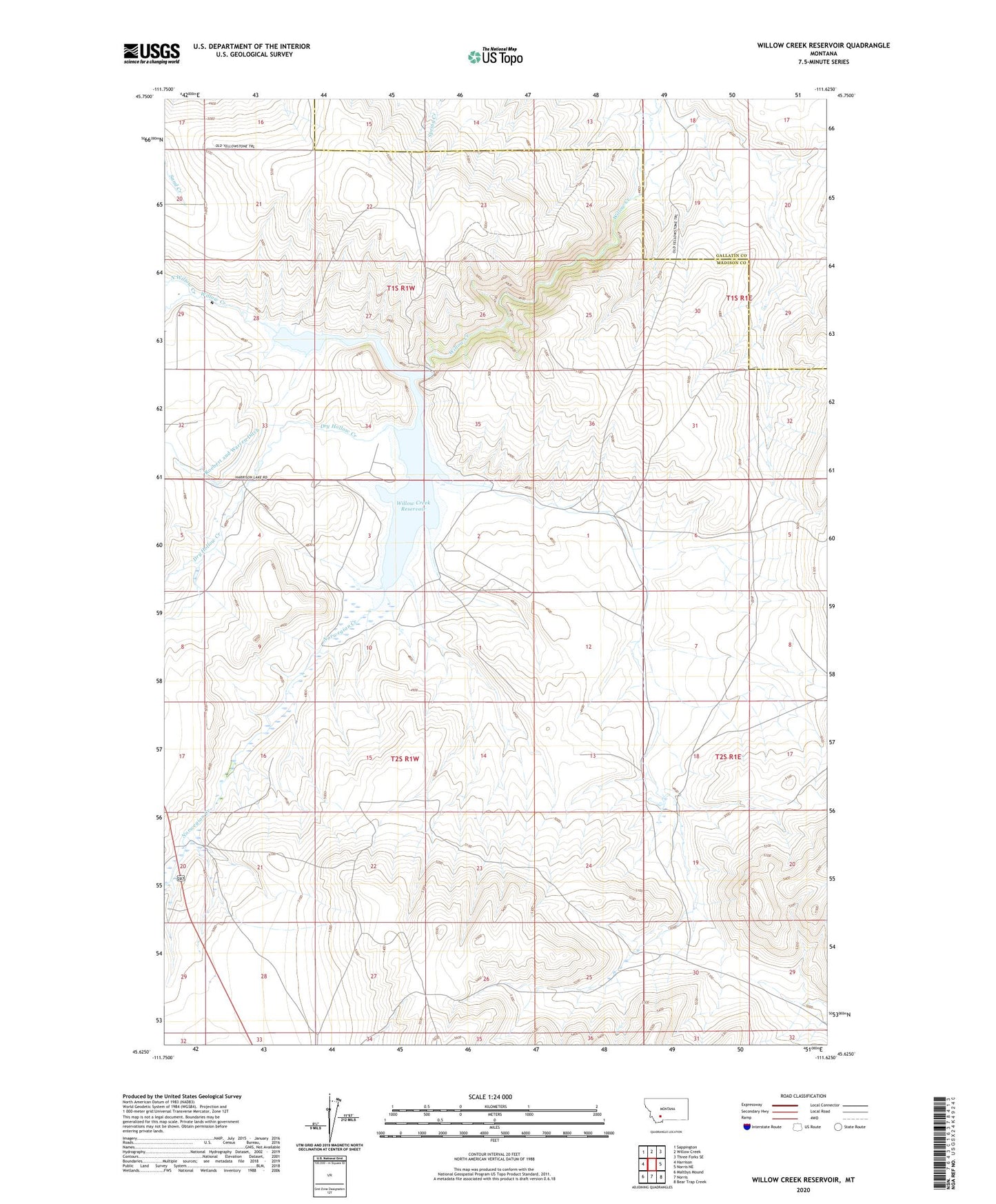
2024 topographic map quadrangle Willow Creek Reservoir in the state of Montana. Scale: 1:24000. Based on the newly updated USGS 7.5' US Topo map series, this map is in the following counties: Madison, Gallatin. The map contains contour data, water features, and other items you are used to seeing on USGS maps, but also has updated roads and other features. This is the next generation of topographic maps. Printed on high-quality waterproof paper with UV fade-resistant inks.
Quads adjacent to this one:
West: Harrison
Northwest: Sappington
North: Willow Creek
Northeast: Three Forks SE
East: Norris NE
Southeast: Bear Trap Creek
South: Norris
Southwest: Maltbys Mound
This map covers the same area as the classic USGS quad with code o45111f6.
Contains the following named places: 01S01W34DCDD01 Well, Dry Hollow Creek, Harrison Lake Campground, Harrison Lake Fishing Access Site, North Willow Creek, Norwegian Creek, South Willow Creek, Willow Creek Dam, Willow Creek Reservoir