MyTopo
Wisdom Montana US Topo Map
Couldn't load pickup availability
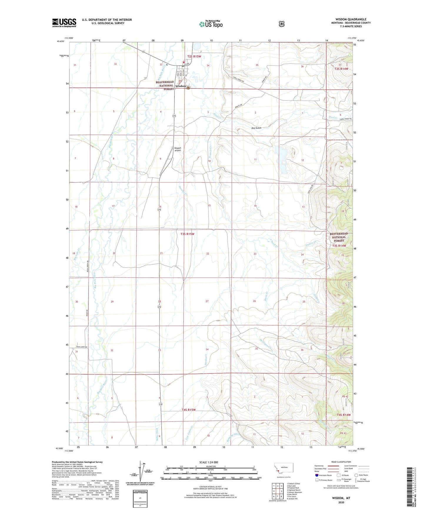
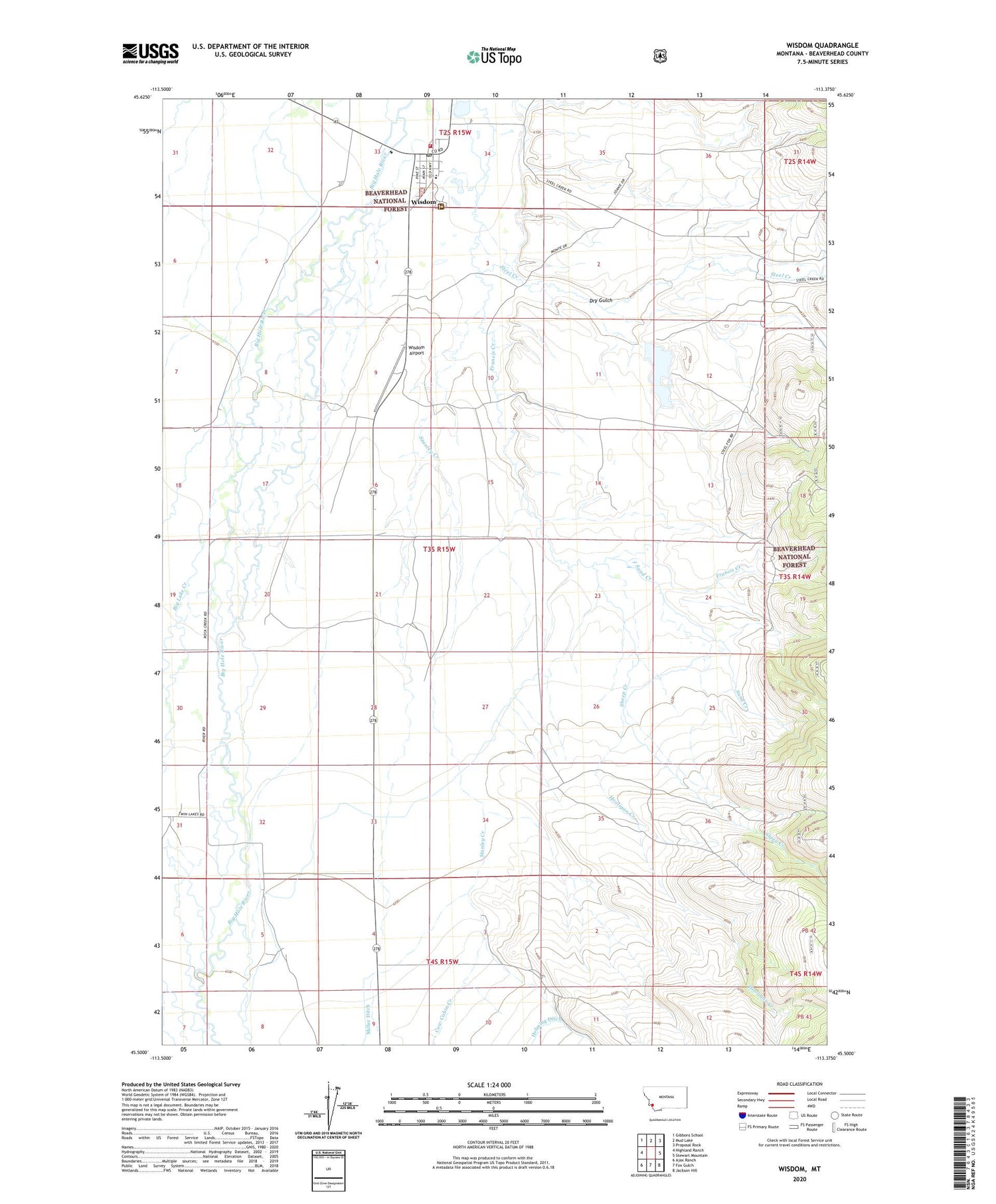
2020 topographic map quadrangle Wisdom in the state of Montana. Scale: 1:24000. Based on the newly updated USGS 7.5' US Topo map series, this map is in the following counties: Beaverhead. The map contains contour data, water features, and other items you are used to seeing on USGS maps, but also has updated roads and other features. This is the next generation of topographic maps. Printed on high-quality waterproof paper with UV fade-resistant inks.
Quads adjacent to this one:
West: Highland Ranch
Northwest: Gibbons School
North: Mud Lake
Northeast: Proposal Rock
East: Stewart Mountain
Southeast: Jackson Hill
South: Fox Gulch
Southwest: Ajax Ranch
Contains the following named places: 02S15W32AABB01 Well, 02S15W32ABAB01 Well, 02S15W33BDDA01 Well, 02S15W33CCAB01 Well, 02S15W33DDBD01 Well, 02S15W34BACC01 Well, 02S15W34BCCD01 Well, 02S15W34CBBB01 Well, 02S15W34CBBC01 Well, 02S15W34CCCB01 Well, 03S15W04ADCD01 Well, 03S15W08CCCA01 Well, 03S15W16DCCD01 Well, 03S15W20DBCC01 Well, 03S15W20DBCC02 Well, 03S15W21DCAB01 Well, 03S15W31DBAB01 Well, 04S15W02CCCB01 Well, 04S15W05BADA01 Well, 04S15W05DBCD01 Well, 04S15W11BBBB01 Well, American Legion Park, Big Hole Basin Division, Big Lake Creek, Clapp Ranch, Clara Mine, Coyote Clems RV Park, D Hirshy, Dry Fields Dam, Dry Gulch, Francis Creek, Francis Ranch, Hooligan Creek, Huntley Home Ranch, M CLemow, Our Lady of Wisdom Mission, Rock Creek, Sand Creek, Sheep Creek, Stanley Creek, Wisdom, Wisdom Airport, Wisdom Census Designated Place, Wisdom Post Office, Wisdom Ranger Station, Wisdom Rural Fire Department, Wisdom School