MyTopo
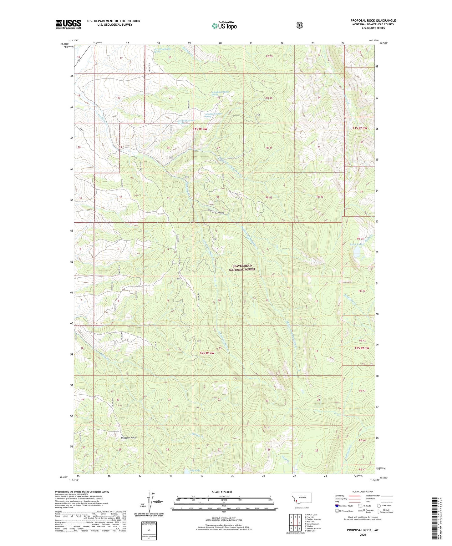
Proposal Rock Montana US Topo Map
Couldn't load pickup availability
Also explore the Proposal Rock Forest Service Topo of this same quad for updated USFS data
2024 topographic map quadrangle Proposal Rock in the state of Montana. Scale: 1:24000. Based on the newly updated USGS 7.5' US Topo map series, this map is in the following counties: Beaverhead. The map contains contour data, water features, and other items you are used to seeing on USGS maps, but also has updated roads and other features. This is the next generation of topographic maps. Printed on high-quality waterproof paper with UV fade-resistant inks.
Quads adjacent to this one:
West: Mud Lake
Northwest: Pintler Lake
North: Pine Hill
Northeast: Foolhen Mountain
East: Shaw Mountain
Southeast: Odell Lake
South: Stewart Mountain
Southwest: Wisdom
This map covers the same area as the classic USGS quad with code o45113f3.
Contains the following named places: 01S14W16CBAD01 Spring, 01S14W18DBAC01 Well, 01S14W20AAAB01 Well, 01S14W22CABA01 Spring, 01S14W22CCDD01 Spring, 01S14W28ABAB01 Spring, Middle Fork Doolittle Creek, North Fork Doolittle Fork Creek, Proposal Rock, Sand Creek, South Fork Doolittle Creek, Stone Lakes