MyTopo
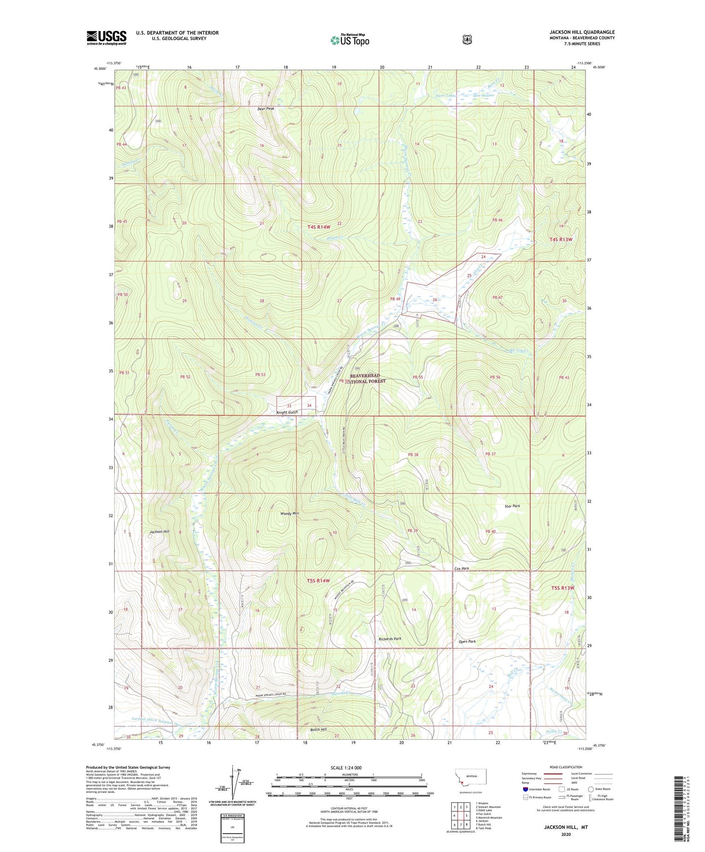
Jackson Hill Montana US Topo Map
Couldn't load pickup availability
Also explore the Jackson Hill Forest Service Topo of this same quad for updated USFS data
2024 topographic map quadrangle Jackson Hill in the state of Montana. Scale: 1:24000. Based on the newly updated USGS 7.5' US Topo map series, this map is in the following counties: Beaverhead. The map contains contour data, water features, and other items you are used to seeing on USGS maps, but also has updated roads and other features. This is the next generation of topographic maps. Printed on high-quality waterproof paper with UV fade-resistant inks.
Quads adjacent to this one:
West: Fox Gulch
Northwest: Wisdom
North: Stewart Mountain
Northeast: Odell Lake
East: Maverick Mountain
Southeast: Tash Peak
South: Butch Hill
Southwest: Jackson
This map covers the same area as the classic USGS quad with code o45113d3.
Contains the following named places: Bear Creek, Carney Mine, Clemow Cow Camp, Cox Creek, Cox Park, Deer Peak, Gloss Upper Ditch, Heath Creek, Hunter Creek, Jackson Creek, Jackson Hill, Jardine Ditch, Knight Gulch, Kunselman Creek, Little Milk Creek, Old Tim Creek, Open Park, Poison Creek, Richards Park, Star Park, Steer Lake, Steer Meadow, West Side Ditch, Woody Creek, Woody Mountain