MyTopo
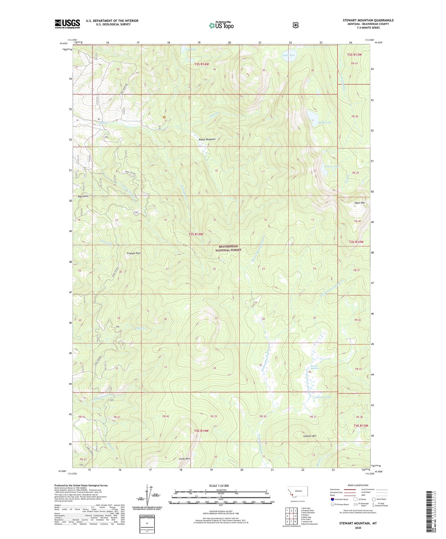
Stewart Mountain Montana US Topo Map
Couldn't load pickup availability
Also explore the Stewart Mountain Forest Service Topo of this same quad for updated USFS data
2024 topographic map quadrangle Stewart Mountain in the state of Montana. Scale: 1:24000. Based on the newly updated USGS 7.5' US Topo map series, this map is in the following counties: Beaverhead. The map contains contour data, water features, and other items you are used to seeing on USGS maps, but also has updated roads and other features. This is the next generation of topographic maps. Printed on high-quality waterproof paper with UV fade-resistant inks.
Quads adjacent to this one:
West: Wisdom
Northwest: Mud Lake
North: Proposal Rock
Northeast: Shaw Mountain
East: Odell Lake
Southeast: Maverick Mountain
South: Jackson Hill
Southwest: Fox Gulch
This map covers the same area as the classic USGS quad with code o45113e3.
Contains the following named places: 03S14W04CACA01 Well, Arnold Mine, Baldy Lake, Bear Mine, Bonanza, Camp Mountain, Coeur D'Alene Mine, East Fork Warm Springs Creek, Elbow Lake, Franklin Number 1 Mine, Last Chance - Sugar Load Mine, Lily Lake, Martin Mine, Maynard Mine, Moose Meadows, North Fork Sheep Creek, Odell Mountain, Sand Lake, Shelly Mine, South Fork Steel Creek, Steel Creek Campground, Steel Creek Ranger Station, Stewart Lake, Stewart Meadows, Stewart Mountain, Triangle Park, West Fork Warm Springs Creek, Wisconsin Creek