MyTopo
Cottonwood Reservoir Montana US Topo Map
Couldn't load pickup availability
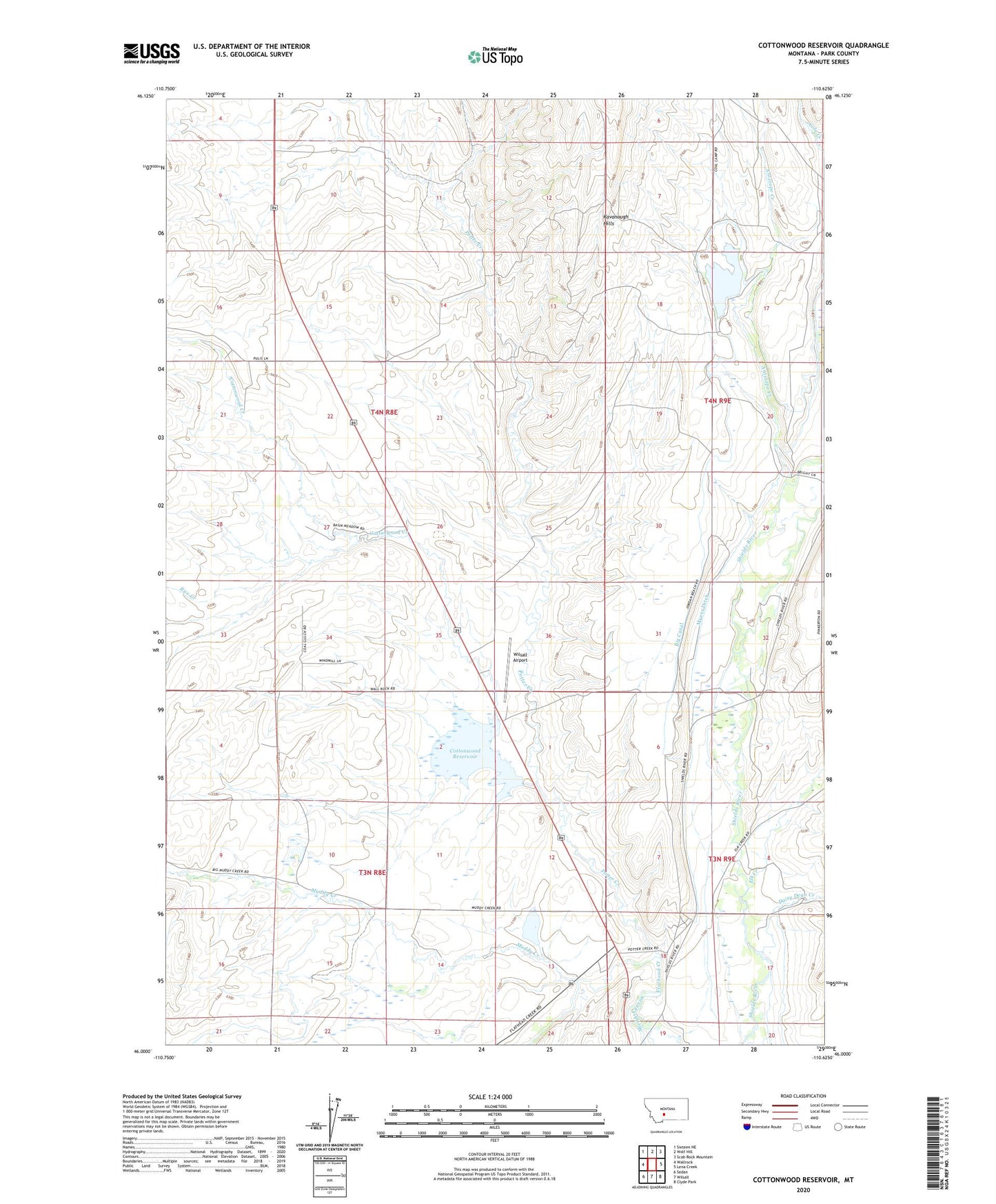
2024 topographic map quadrangle Cottonwood Reservoir in the state of Montana. Scale: 1:24000. Based on the newly updated USGS 7.5' US Topo map series, this map is in the following counties: Park. The map contains contour data, water features, and other items you are used to seeing on USGS maps, but also has updated roads and other features. This is the next generation of topographic maps. Printed on high-quality waterproof paper with UV fade-resistant inks.
Quads adjacent to this one:
West: Wallrock
Northwest: Sixteen NE
North: Wolf Hill
Northeast: Scab Rock Mountain
East: Lena Creek
Southeast: Clyde Park
South: Wilsall
Southwest: Sedan
This map covers the same area as the classic USGS quad with code o46110a6.
Contains the following named places: 03N08E04A___01 Well, 03N08E10C___01 Well, 03N09E07B___01 Well, 03N09E08C___01 Well, 03N09E08D___01 Well, 04N08E09A___01 Well, 04N08E27A___01 Well, 04N09E31B___01 Well, 04N09E32C___01 Well, Antelope Creek, Big Canal, Cottonwood Creek, Cottonwood Dam, Cottonwood Reservoir, Daisy Dean Creek, Elk Creek, Jordan Dam, Kaiser Dam, Kavanaugh Hills, Landers Number 1 Dam, Meyersburg, Meyersburg Post Office, Muddy Creek, Myers Ditch, Potter Creek, Rice Creek, Sheilds Canyon, Wilsall Airport