MyTopo
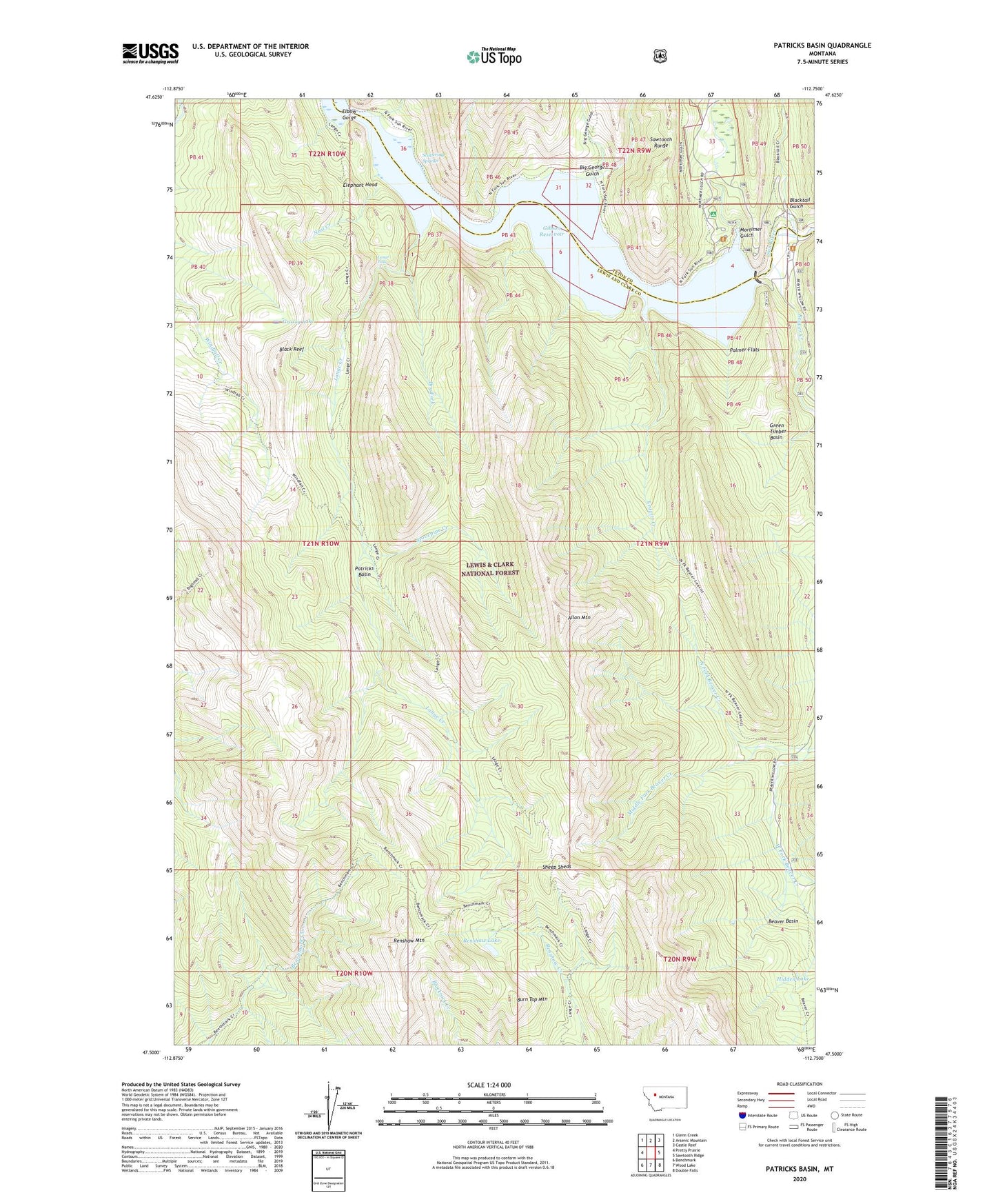
Patricks Basin Montana US Topo Map
Couldn't load pickup availability
Also explore the Patricks Basin Forest Service Topo of this same quad for updated USFS data
2024 topographic map quadrangle Patricks Basin in the state of Montana. Scale: 1:24000. Based on the newly updated USGS 7.5' US Topo map series, this map is in the following counties: Lewis and Clark, Teton. The map contains contour data, water features, and other items you are used to seeing on USGS maps, but also has updated roads and other features. This is the next generation of topographic maps. Printed on high-quality waterproof paper with UV fade-resistant inks.
Quads adjacent to this one:
West: Pretty Prairie
Northwest: Glenn Creek
North: Arsenic Mountain
Northeast: Castle Reef
East: Sawtooth Ridge
Southeast: Double Falls
South: Wood Lake
Southwest: Benchmark
This map covers the same area as the classic USGS quad with code o47112e7.
Contains the following named places: Allan Mountain, Beaver Basin, Beaver Creek, Big George Gulch, Black Reef, Blacktail Gulch, Burn Top Mountain, Dry Fork, Elbow Gorge, Elephant Head, Gibson Dam, Gibson Lake Lodge, Gibson Overlook, Gibson Reservoir, Grassy Lake, Green Timber Basin, Hidden Lake, Klick Lower Ranch, Lange Creek, Lange Falls, Leavitt Creek, Middle Fork Beaver Creek, Mortimer Gulch, Mortimer Gulch Campground, Mortimer Gulch Trailhead, Neal Creek, North Fork Beaver Creek, North Fork Sun River, Palmer Flats, Patricks Basin, Renshaw Lake, Renshaw Mountain, Scattering Springs, Sheep Sheds, Stovepipe Creek, West Fork Beaver Creek