MyTopo
Belgrade SE Nebraska US Topo Map
Couldn't load pickup availability
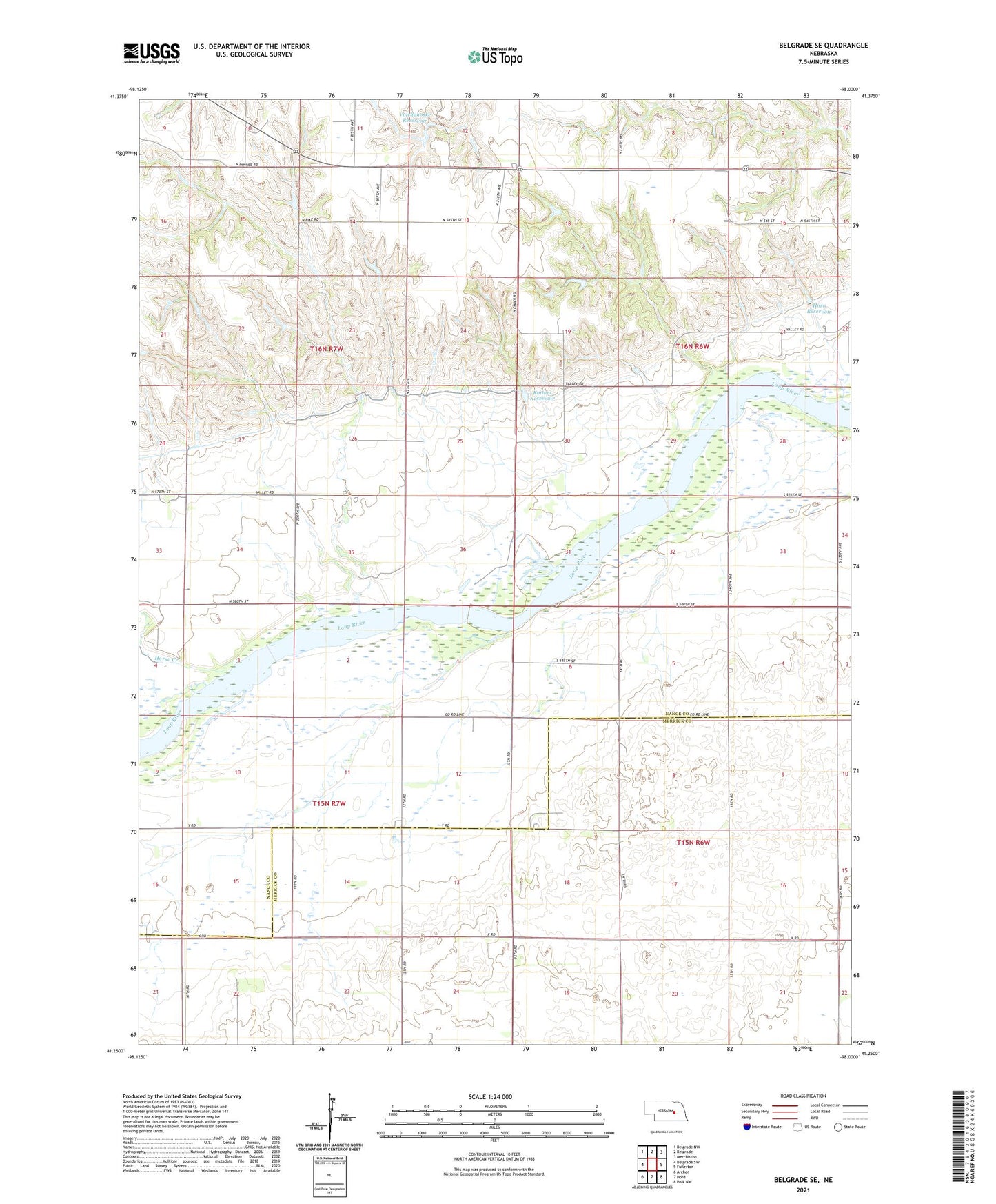
2021 topographic map quadrangle Belgrade SE in the state of Nebraska. Scale: 1:24000. Based on the newly updated USGS 7.5' US Topo map series, this map is in the following counties: Nance, Merrick. The map contains contour data, water features, and other items you are used to seeing on USGS maps, but also has updated roads and other features. This is the next generation of topographic maps. Printed on high-quality waterproof paper with UV fade-resistant inks.
Quads adjacent to this one:
West: Belgrade SW
Northwest: Belgrade NW
North: Belgrade
Northeast: Merchiston
East: Fullerton
Southeast: Polk NW
South: Hord
Southwest: Archer
This map covers the same area as the classic USGS quad with code o41098c1.
Contains the following named places: Horn Dam, Horn Reservoir, Horse Creek, Kotlarz Dam, Kotlarz Reservoir, Liberty Knoll School, Pleasant Valley Public School, School Number 16, School Number 5, School Number 51, School Number 55, School Number 56, School Number 9, South Side Church, Township of Fullerton, Township of Loup Ferry, Township of West Newman, Voichahoske Dam, Voichahoske Reservoir