MyTopo
Beaver Crossing Nebraska US Topo Map
Couldn't load pickup availability
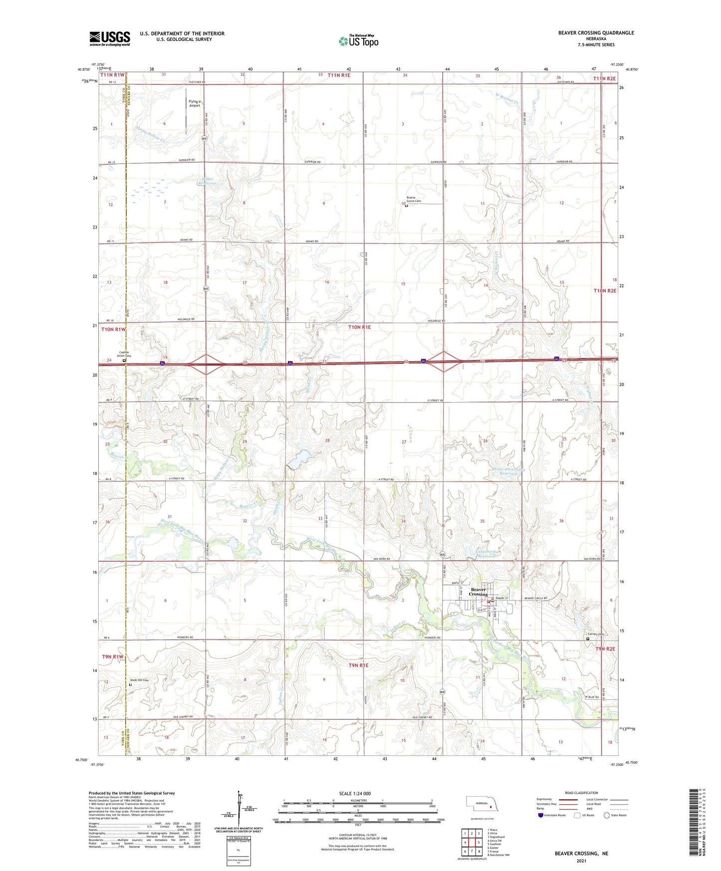
2021 topographic map quadrangle Beaver Crossing in the state of Nebraska. Scale: 1:24000. Based on the newly updated USGS 7.5' US Topo map series, this map is in the following counties: Seward, York. The map contains contour data, water features, and other items you are used to seeing on USGS maps, but also has updated roads and other features. This is the next generation of topographic maps. Printed on high-quality waterproof paper with UV fade-resistant inks.
Quads adjacent to this one:
West: Utica SW
Northwest: Waco
North: Utica
Northeast: Staplehurst
East: Goehner
Southeast: Dorchester NW
South: Friend
Southwest: Exeter
Contains the following named places: Beaver Creek, Beaver Crossing, Beaver Crossing City Park, Beaver Crossing City Park Campground, Beaver Crossing Community Library, Beaver Crossing Mill Historical Marker, Beaver Crossing Nebraska Historical Marker, Beaver Crossing Police Department, Beaver Crossing Post Office, Beaver Crossing Volunteer Fire Department, Blue Valley Cooperative Elevator, Brackhan Reservoir, Brackhan-Marquardt Road Dam, Calvary Cemetery, Cashler Union Cemetery, Election Precinct L, Faith Christian School, Flying V Airport, Indian Creek, Knob Hill Cemetery, Langworthy Dam, Langworthy Reservoir, Miller Dam, Miller Reservoir, Miller-Flowerday Reservoir, Miller-Flowerday Road Dam, Phillips Airport, Prairie Grove Cemetery, Precinct M Beaver Crossing Election Precinct, Sacred Heart Catholic Church, Sleepy Hollow Creek, Smith Creek, Township L, Village of Beaver Crossing, ZIP Code: 68313