MyTopo
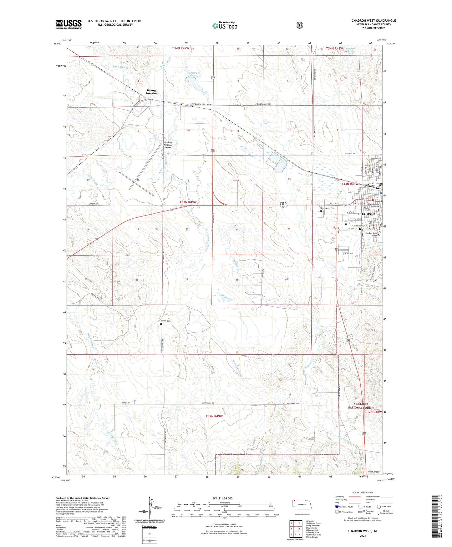
Chadron West Nebraska US Topo Map
Couldn't load pickup availability
Also explore the Chadron West Forest Service Topo of this same quad for updated USFS data
2021 topographic map quadrangle Chadron West in the state of Nebraska. Scale: 1:24000. Based on the newly updated USGS 7.5' US Topo map series, this map is in the following counties: Dawes. The map contains contour data, water features, and other items you are used to seeing on USGS maps, but also has updated roads and other features. This is the next generation of topographic maps. Printed on high-quality waterproof paper with UV fade-resistant inks.
Quads adjacent to this one:
West: Trunk Butte
Northwest: Wayside
North: Bohemian Creek
Northeast: Isinglass Buttes
East: Chadron East
Southeast: Kings Canyon
South: Coffee Mill Butte
Southwest: Chimney Butte
This map covers the same area as the classic USGS quad with code o42103g1.
Contains the following named places: Activity Center, Administration Building, Adventist Elementary School, Boog Horse Park, Calvary Cemetery, Chadron Commercial Historic District, Chadron Community Church, Chadron Community Hospital, Chadron Creek, Chadron Creek Trading Post Historical Marker, Chadron Grain Elevator, Chadron Municipal Airport, Chadron Police Department, Chadron Post Office, Chadron Public Library, Chadron State College, Chadron State College Historical Marker, Chadron Volunteer Fire Department, Chadron Work Center, Church of Christ, City of Chadron, Congregational Church, Crest View Manor, Crites Hall, Dakota Junction, Dawes County Courthouse, Dawes County Historical Museum, Dawes County Sheriff's Office, Edna G Work Hall, Edna G Work Wing, Election Precinct 02, Election Precinct 05, Election Precinct 08, Elliott Field, First Baptist Church, First Congregational Church, Greenwood Cemetery, Hildreth Hall, J and L RV Park, J and L Trailer Court, KCNE-FM (Chadron), KCSR Radio Tower (Biloxi), KCSR-AM (Chadron), Lone Tree Creek, Mayfield Dam, Media Center, Memorial Hall, Miller Hall, Panhandle Mental Health Center, Pine Ridge, Pine Ridge District Ranger Office, Reorganized Church of Jesus Christ of Latter Day Saints, Ridgeview Country Club, Shisler Cemetery, Sparks Hall, Spring Creek Dam, Spring Creek Reservoir, The First Church in Chadron Historical Marker, The Fort Pierre - Fort Laramie Trail Historical Marker, Trunk Butte School, Wagon Wheel Trailer Court, West Court Family Housing, West Fork Chadron Creek, Westview Mobile Park, Wilson Park, ZIP Code: 69337