MyTopo
Trunk Butte Nebraska US Topo Map
Couldn't load pickup availability
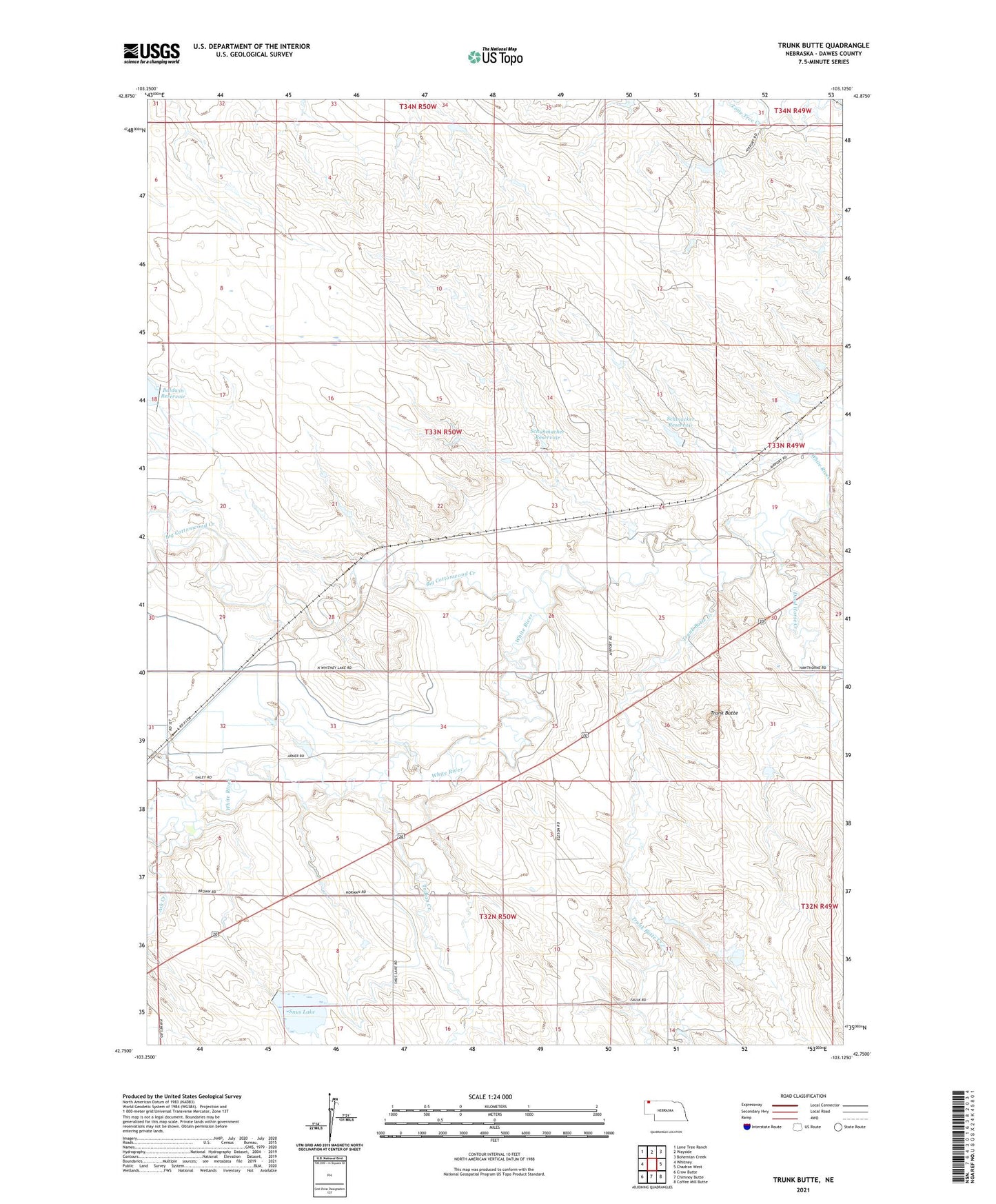
2021 topographic map quadrangle Trunk Butte in the state of Nebraska. Scale: 1:24000. Based on the newly updated USGS 7.5' US Topo map series, this map is in the following counties: Dawes. The map contains contour data, water features, and other items you are used to seeing on USGS maps, but also has updated roads and other features. This is the next generation of topographic maps. Printed on high-quality waterproof paper with UV fade-resistant inks.
Quads adjacent to this one:
West: Whitney
Northwest: Lone Tree Ranch
North: Wayside
Northeast: Bohemian Creek
East: Chadron West
Southeast: Coffee Mill Butte
South: Chimney Butte
Southwest: Crow Butte
This map covers the same area as the classic USGS quad with code o42103g2.
Contains the following named places: Ash Creek, Baldwin Dam, Baldwin Reservoir, Big Cottonwood Creek, Bull Creek, Dead Horse Creek, Fox Dam, Fox Reservoir, Indian Creek, Norman Dam, Norman Reservoir, Schmacker Dam, Schmacker Reservoir, Schuhmacher Dam, Schuhmacher Reservoir, Snus Lake, Trunk Butte, Trunk Butte Creek