MyTopo
Cook Nebraska US Topo Map
Couldn't load pickup availability
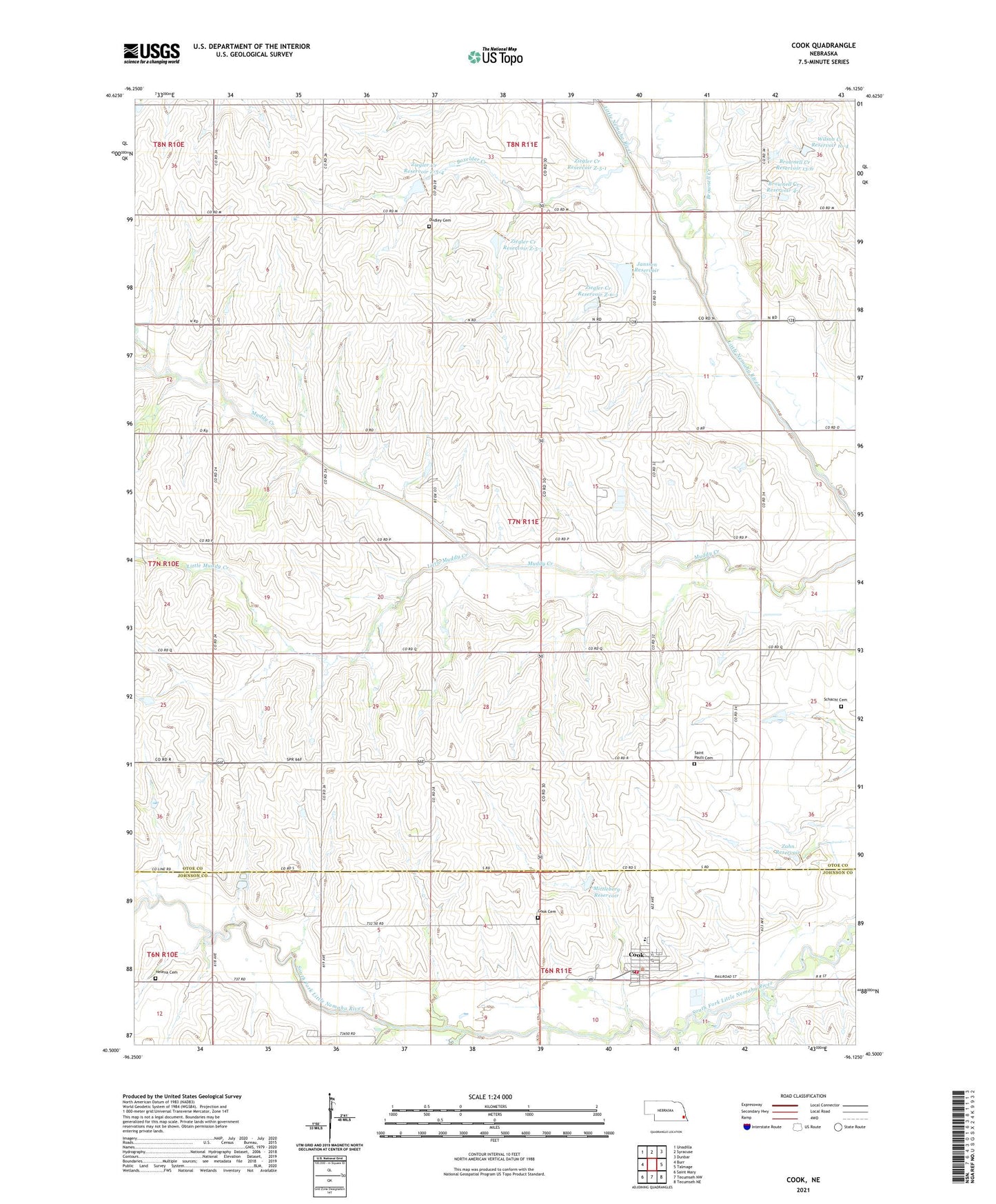
2021 topographic map quadrangle Cook in the state of Nebraska. Scale: 1:24000. Based on the newly updated USGS 7.5' US Topo map series, this map is in the following counties: Otoe, Johnson. The map contains contour data, water features, and other items you are used to seeing on USGS maps, but also has updated roads and other features. This is the next generation of topographic maps. Printed on high-quality waterproof paper with UV fade-resistant inks.
Quads adjacent to this one:
West: Burr
Northwest: Unadilla
North: Syracuse
Northeast: Dunbar
East: Talmage
Southeast: Tecumseh NE
South: Tecumseh NW
Southwest: Saint Mary
This map covers the same area as the classic USGS quad with code o40096e2.
Contains the following named places: Boxelder Creek, Brownell Creek, Brownell Creek Dam 13-4, Brownell Creek Dam 13-6, Brownell Creek Dam 4-1, Brownell Creek Reservoir 13-6, Brownell Creek Reservoir 4-1, Cook, Cook Cemetery, Cook Historical Marker, Cook Post Office, Cook Public Library, Cook Rural Fire District, Coon Creek, Dudley Cemetery, Evergreen School, Farmers Cooperative Elevator Company Elevator, Grace Lutheran Church, Helena, Helena Cemetery, Helena Post Office, Janssen Dam, Janssen Reservoir, Johnson County Ambulance Service Cook Rescue, Little Muddy Creek, Mittleberg Dam, Mittleberg Reservoir, Nemaha Valley School, Nissen Spur, Osage Election Precinct, Saint Pauls Church, Schacht Cemetery, Township of Osage, Turkey Creek, Valley School, Village of Cook, Wilson Creek Reservoir 1o-4, Zahn Dam, Zahn Reservoir, Ziegler Creek Dam Z-5-1, Ziegler Creek Dam Z-5-3, Ziegler Creek Dam Z-5-4, Ziegler Creek Dam Z-6-2, Ziegler Creek Reservoir Z-5-1, Ziegler Creek Reservoir Z-5-3, Ziegler Creek Reservoir Z-5-4, Ziegler Creek Reservoir Z-6-2