MyTopo
Tecumseh NW Nebraska US Topo Map
Couldn't load pickup availability
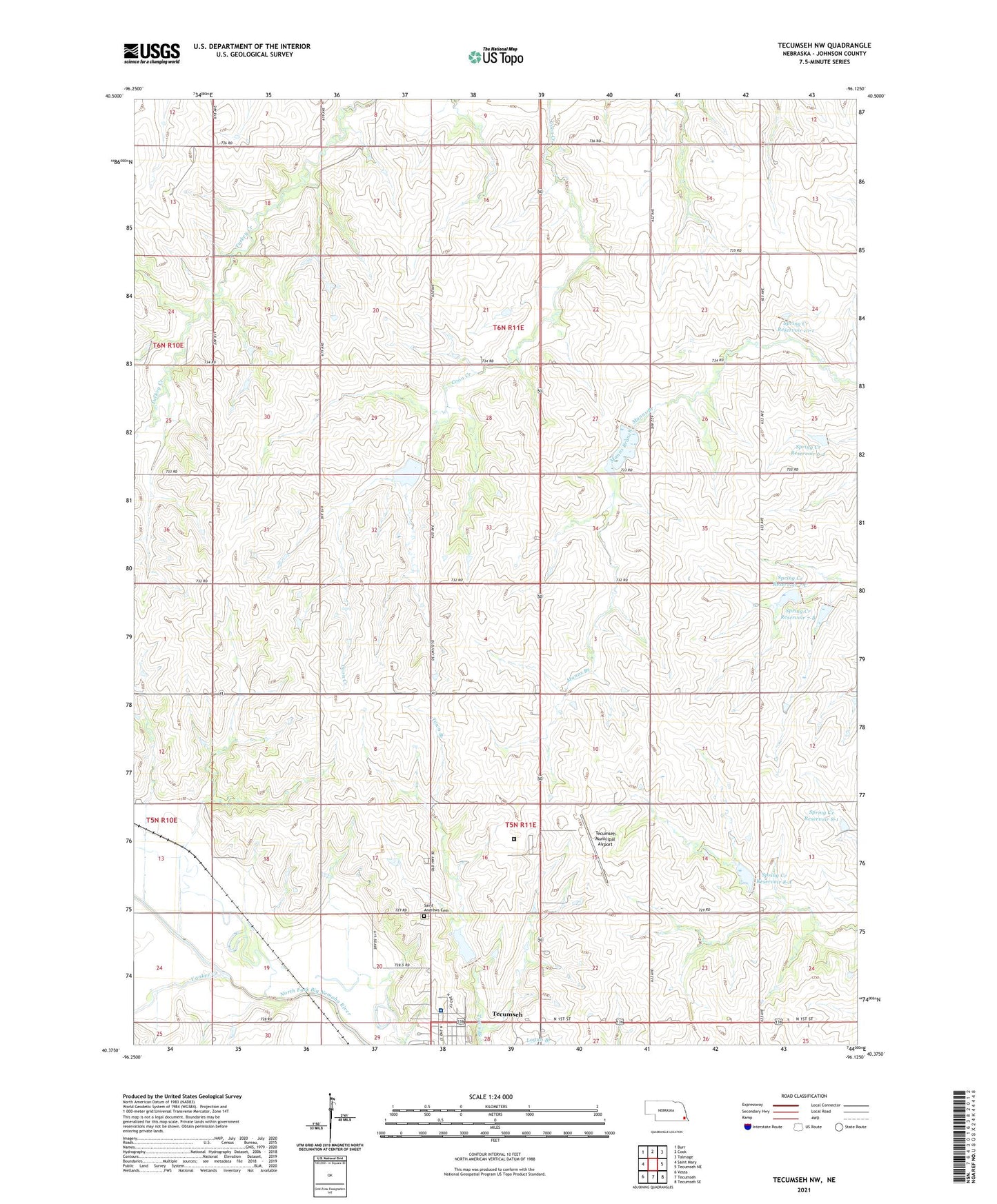
2021 topographic map quadrangle Tecumseh NW in the state of Nebraska. Scale: 1:24000. Based on the newly updated USGS 7.5' US Topo map series, this map is in the following counties: Johnson. The map contains contour data, water features, and other items you are used to seeing on USGS maps, but also has updated roads and other features. This is the next generation of topographic maps. Printed on high-quality waterproof paper with UV fade-resistant inks.
Quads adjacent to this one:
West: Saint Mary
Northwest: Burr
North: Cook
Northeast: Talmage
East: Tecumseh NE
Southeast: Tecumseh SE
South: Tecumseh
Southwest: Vesta
This map covers the same area as the classic USGS quad with code o40096d2.
Contains the following named places: Bear, Belle Terrace of Tecumseh, Johnson County Ambulance Service Tecumseh Rescue, Johnson County Hospital, Nemaha Election Precinct, Osage State Wildlife Management Area, Saint Andrews Cemetery, Sandridge School, Spring Creek Dam 10-1, Spring Creek Dam 6-2, Spring Creek Dam 7-B, Spring Creek Dam 7-C, Spring Creek Dam 8-1, Spring Creek Dam 8-A, Spring Creek Election Precinct, Spring Creek Reservoir 10-1, Spring Creek Reservoir 6-2, Spring Creek Reservoir 7-B, Spring Creek Reservoir 7-C, Spring Creek Reservoir 8-1, Spring Creek Reservoir 8-A, Tecumseh Municipal Airport, Tecumseh State Correctional Institution, Tecumseh State Correctional Institution Medical Service, Township of Nemaha, Township of Spring Creek, Warner School, Yankee Creek, ZIP Code: 68329