MyTopo
Crofton Nebraska US Topo Map
Couldn't load pickup availability
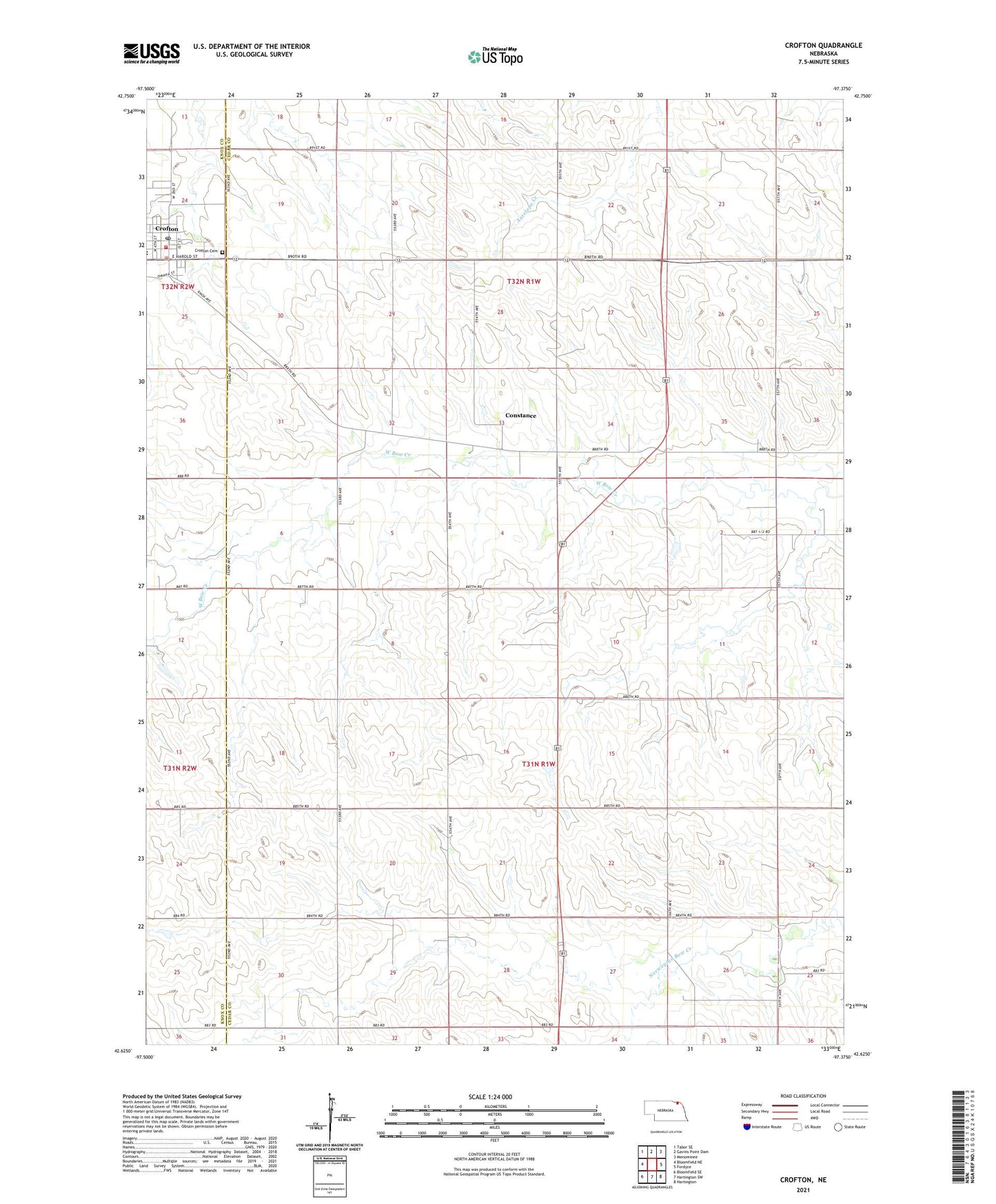
2021 topographic map quadrangle Crofton in the state of Nebraska. Scale: 1:24000. Based on the newly updated USGS 7.5' US Topo map series, this map is in the following counties: Cedar, Knox. The map contains contour data, water features, and other items you are used to seeing on USGS maps, but also has updated roads and other features. This is the next generation of topographic maps. Printed on high-quality waterproof paper with UV fade-resistant inks.
Quads adjacent to this one:
West: Bloomfield NE
Northwest: Tabor SE
North: Gavins Point Dam
Northeast: Menominee
East: Fordyce
Southeast: Hartington
South: Hartington SW
Southwest: Bloomfield SE
This map covers the same area as the classic USGS quad with code o42097f4.
Contains the following named places: City of Crofton, Constance, Constance Post Office, Crofton, Crofton Cemetery, Crofton Community Schools, Crofton Elevator Incorporated Elevator, Crofton Police Department, Crofton Post Office, Crofton Rescue, Crofton Volunteer Fire Department, Eastern Township Library, Election Precinct 10, Election Precinct 3, Northside Park, Precinct Ten, Precinct Three, Sacred Heart Medical Clinic, Saint Joseph School, Southside Park, Strunk Health Center, Trinity Lutheran Church, Tristate Dental