
MyTopo
Trumbull Nebraska US Topo Map
Couldn't load pickup availability
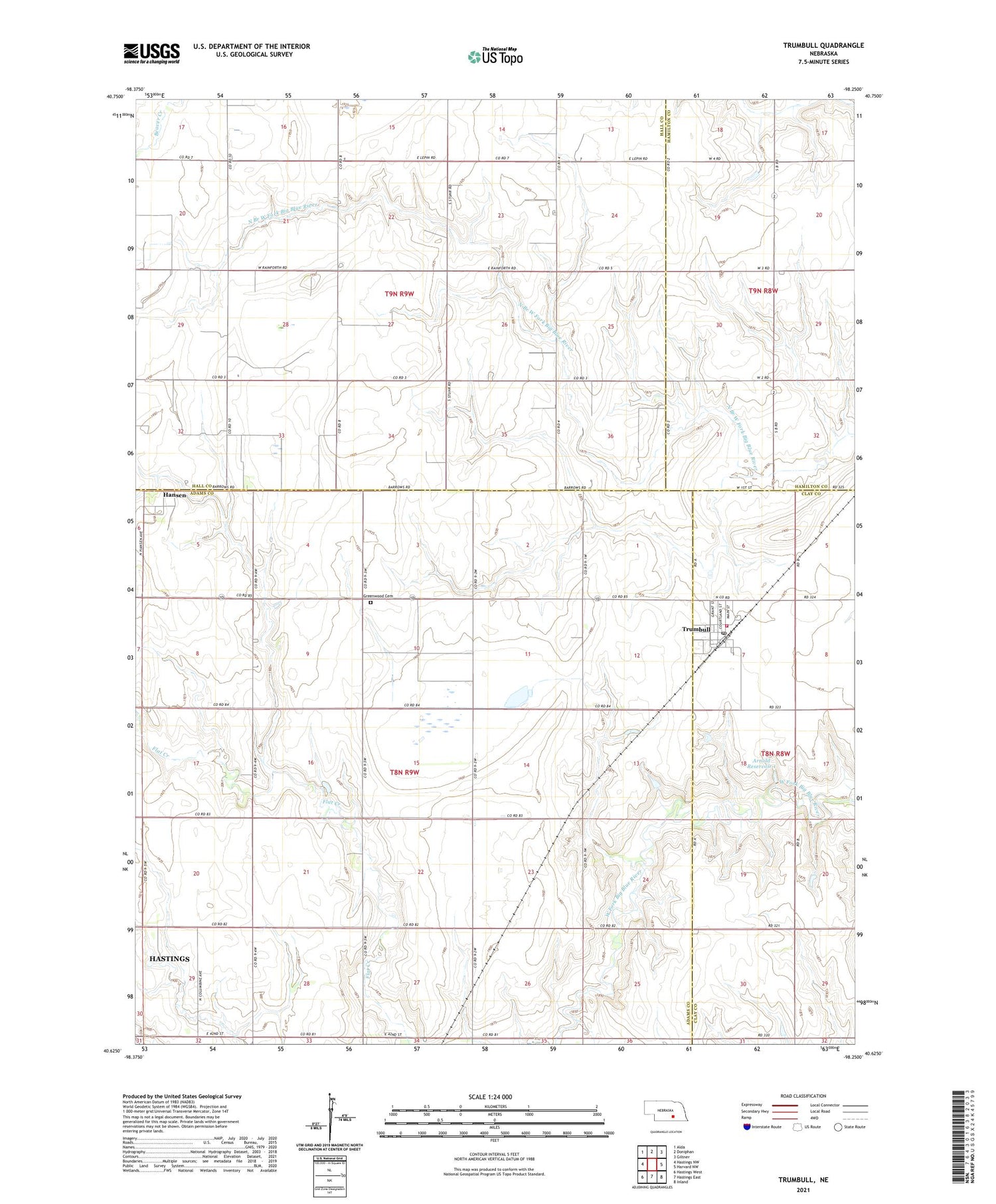
2021 topographic map quadrangle Trumbull in the state of Nebraska. Scale: 1:24000. Based on the newly updated USGS 7.5' US Topo map series, this map is in the following counties: Adams, Hall, Clay, Hamilton. The map contains contour data, water features, and other items you are used to seeing on USGS maps, but also has updated roads and other features. This is the next generation of topographic maps. Printed on high-quality waterproof paper with UV fade-resistant inks.
Quads adjacent to this one:
West: Hastings NW
Northwest: Alda
North: Doniphan
Northeast: Giltner
East: Harvard NW
Southeast: Inland
South: Hastings East
Southwest: Hastings West
This map covers the same area as the classic USGS quad with code o40098f3.
Contains the following named places: Arnold Dam 1, Arnold Reservoir 1, Christian Church, Greenwood Cemetery, Hansen, Hansen Post Office, Heartland Co-op Elevator, Township of West Blue, Tri-View Public School, Trumbull, Trumbull Post Office, Trumbull Public Schools, Trumbull Rural Volunteer Fire Department, United Methodist Church, Village of Trumbull, ZIP Code: 68980


