MyTopo
Emerson Nebraska US Topo Map
Couldn't load pickup availability
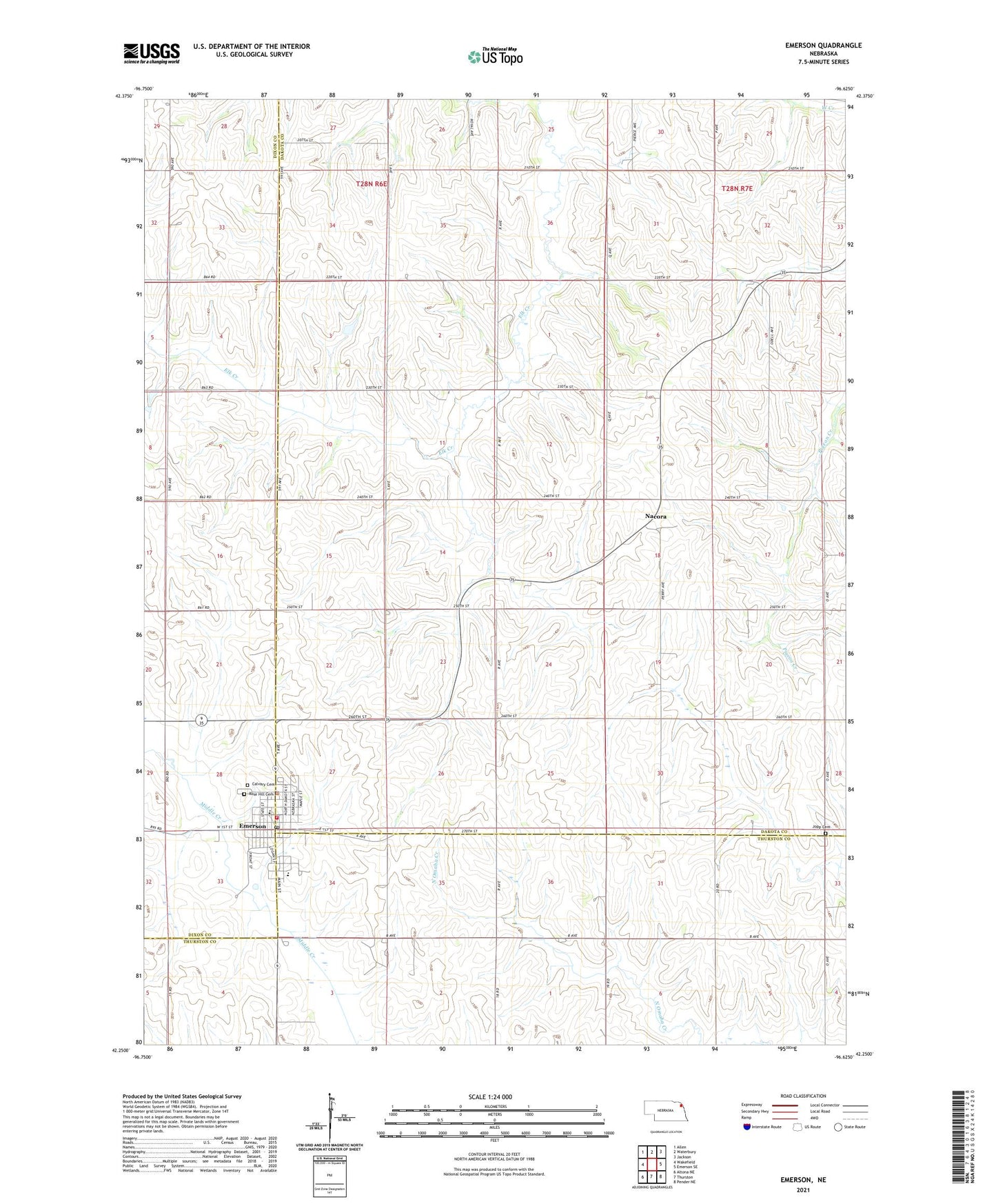
2021 topographic map quadrangle Emerson in the state of Nebraska. Scale: 1:24000. Based on the newly updated USGS 7.5' US Topo map series, this map is in the following counties: Dakota, Thurston, Dixon. The map contains contour data, water features, and other items you are used to seeing on USGS maps, but also has updated roads and other features. This is the next generation of topographic maps. Printed on high-quality waterproof paper with UV fade-resistant inks.
Quads adjacent to this one:
West: Wakefield
Northwest: Allen
North: Waterbury
Northeast: Jackson
East: Emerson SE
Southeast: Pender NE
South: Thurston
Southwest: Altona NE
This map covers the same area as the classic USGS quad with code o42096c6.
Contains the following named places: Calvary Cemetery, Emerson, Emerson City Police Department, Emerson Election Precinct, Emerson Hubbard High School, Emerson Medical Clinic, Emerson Post Office, Emerson Public Library, Emerson Volunteer Fire and Rescue, Emerson-Hubbard Elementary School, Heritage of Emerson, Jopp Cemetery, Mueller Grain Elevator, Nacora, Nacora Post Office, Rose Hill Cemetery, Sacred Heart Catholic Church, Sacred Heart School, Saint Luke Lutheran Church, Saint Pauls Lutheran Church, Township of Emerson, Village of Emerson, ZIP Code: 68733