MyTopo
Jackson Nebraska US Topo Map
Couldn't load pickup availability
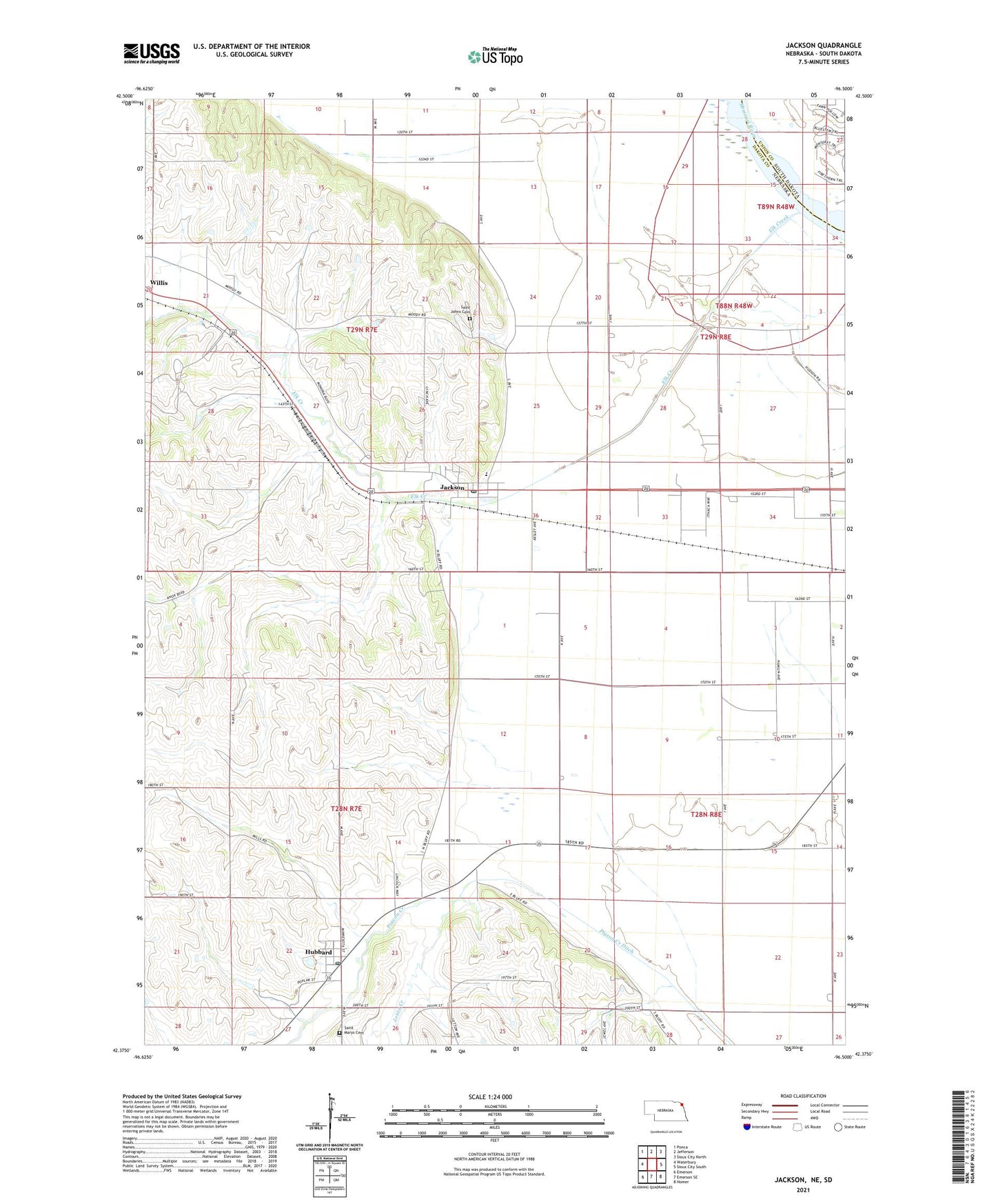
2021 topographic map quadrangle Jackson in the state of Nebraska. Scale: 1:24000. Based on the newly updated USGS 7.5' US Topo map series, this map is in the following counties: Dakota, Union. The map contains contour data, water features, and other items you are used to seeing on USGS maps, but also has updated roads and other features. This is the next generation of topographic maps. Printed on high-quality waterproof paper with UV fade-resistant inks.
Quads adjacent to this one:
West: Waterbury
Northwest: Ponca
North: Jefferson
Northeast: Sioux City North
East: Sioux City South
Southeast: Homer
South: Emerson SE
Southwest: Emerson
Contains the following named places: Coburn, Dakota County, Elk Creek, Hubbard, Hubbard Election Precinct, Hubbard Post Office, Jackson, Jackson Post Office, Jackson Public School, Jones Creek, Lewis and Clark Camp Site Historical Marker, Saint Johns Cemetery, Saint Johns Historical Marker, Saint Mary Catholic Church, Saint Marys Cemetery, Saint Patricks Catholic Church, Village of Hubbard, Village of Jackson, ZIP Code: 68743