MyTopo
Goehner Nebraska US Topo Map
Couldn't load pickup availability
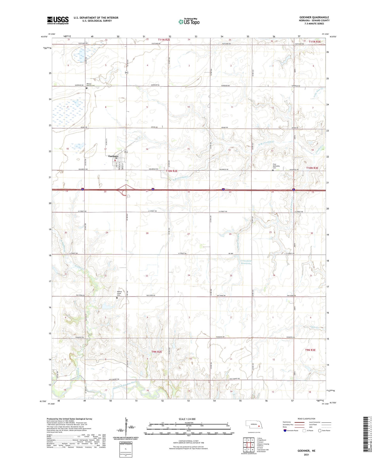
2021 topographic map quadrangle Goehner in the state of Nebraska. Scale: 1:24000. Based on the newly updated USGS 7.5' US Topo map series, this map is in the following counties: Seward. The map contains contour data, water features, and other items you are used to seeing on USGS maps, but also has updated roads and other features. This is the next generation of topographic maps. Printed on high-quality waterproof paper with UV fade-resistant inks.
Quads adjacent to this one:
West: Beaver Crossing
Northwest: Utica
North: Staplehurst
Northeast: Seward
East: Milford
Southeast: Dorchester
South: Dorchester NW
Southwest: Friend
Contains the following named places: Centerfield Reservoir, Ebers-Eberspacher Dam, Election Precinct K, First Methodist Cemetery, Goehner, Goehner Post Office, Goehner Rest Area, Goehner Volunteer Fire Department, KOLN-TV (Lincoln), Mound Prairie Cemetery, North Branch Crooked Creek, Salem Church, Seward County, Seward County Historical Society Museum, South Branch Crooked Creek, Star School, Tall Grass Prairie Historical Marker, Township K, Village of Goehner, Walnut Creek, Walnut Creek Cemetery, West Fairview Church, West Walnut Creek, ZIP Code: 68364