MyTopo
Hay Springs SE Nebraska US Topo Map
Couldn't load pickup availability
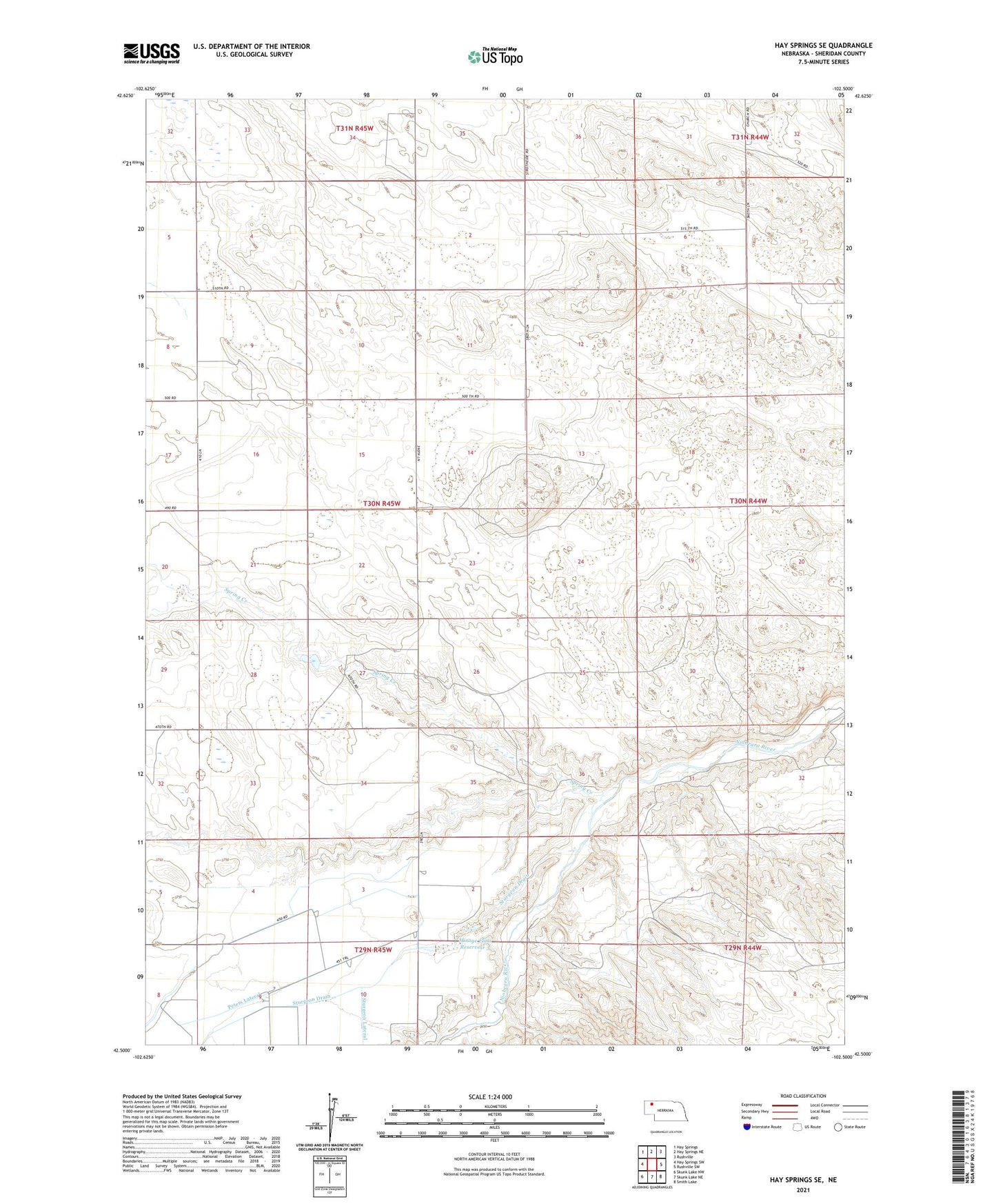
2021 topographic map quadrangle Hay Springs SE in the state of Nebraska. Scale: 1:24000. Based on the newly updated USGS 7.5' US Topo map series, this map is in the following counties: Sheridan. The map contains contour data, water features, and other items you are used to seeing on USGS maps, but also has updated roads and other features. This is the next generation of topographic maps. Printed on high-quality waterproof paper with UV fade-resistant inks.
Quads adjacent to this one:
West: Hay Springs SW
Northwest: Hay Springs
North: Hay Springs NE
Northeast: Rushville
East: Rushville SW
Southeast: Smith Lake
South: Skunk Lake NE
Southwest: Skunk Lake NW
Contains the following named places: Banner School, Immanuel Church, Mirage Flats Dam 3, Mirage Flats Reservoir 3, Peters Lateral, River View School, Sacred Heart Church, Spring Creek, Sturgeon Drain