MyTopo
Hoskins Nebraska US Topo Map
Couldn't load pickup availability
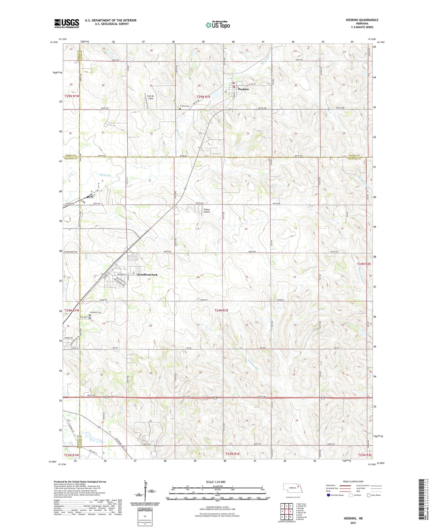
2021 topographic map quadrangle Hoskins in the state of Nebraska. Scale: 1:24000. Based on the newly updated USGS 7.5' US Topo map series, this map is in the following counties: Stanton, Wayne, Madison, Pierce. The map contains contour data, water features, and other items you are used to seeing on USGS maps, but also has updated roads and other features. This is the next generation of topographic maps. Printed on high-quality waterproof paper with UV fade-resistant inks.
Quads adjacent to this one:
West: Norfolk
Northwest: Wee Town
North: Norfolk NE
Northeast: Winside
East: Wayne SW
Southeast: Stanton
South: Madison NE
Southwest: Enola
Contains the following named places: Falk Air Field, Fore - Quarters Feedlot, Hope, Hoskins, Hoskins Post Office, Hoskins Trinity Lutheran Church, Hoskins Volunteer Fire District, Kohles Airport, Lutheran Cemetery, Nucor Steel Emergency Squad, Peace Church, Peace United Church of Christ, School Number 10, School Number 11, School Number 26, Spring Branch 2 Election Precinct, Spring Branch Election Precinct, Township of Spring Branch, Trinity Cemetery, Trinity Lutheran Elementary School, Village of Hoskins, Woodland Park Census Designated Place, Woodland Park Elementary School, Woodland Park Fire and Rescue, Zion Cemetery