MyTopo
Homer Nebraska US Topo Map
Couldn't load pickup availability
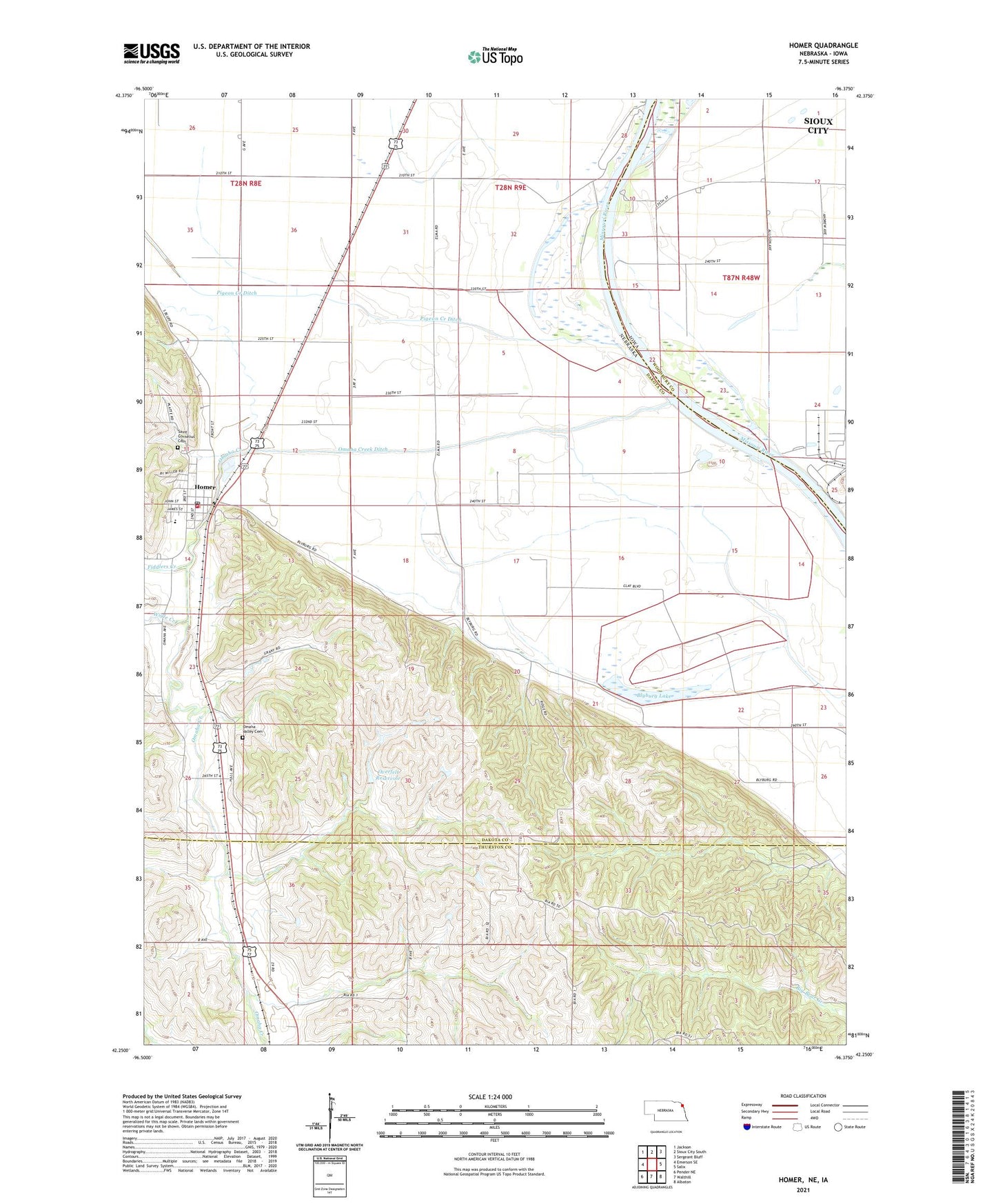
2021 topographic map quadrangle Homer in the states of Nebraska, Iowa. Scale: 1:24000. Based on the newly updated USGS 7.5' US Topo map series, this map is in the following counties: Dakota, Thurston, Woodbury. The map contains contour data, water features, and other items you are used to seeing on USGS maps, but also has updated roads and other features. This is the next generation of topographic maps. Printed on high-quality waterproof paper with UV fade-resistant inks.
Quads adjacent to this one:
West: Emerson SE
Northwest: Jackson
North: Sioux City South
Northeast: Sergeant Bluff
East: Salix
Southeast: Albaton
South: Walthill
Southwest: Pender NE
This map covers the same area as the classic USGS quad with code o42096c4.
Contains the following named places: Blyburg Lake, Combs School, Fiddlers Creek, Homer, Homer Community Schools, Homer Post Office, Homer Volunteer Fire and Rescue, Mile Long Island Wildlife Management Area, O'Connor House Museum Complex, Omadi Election Precinct, Omaha Creek, Omaha Creek Ditch, Omaha Valley Cemetery, Overfelt Dam, Overfelt Reservoir, Pigeon Creek, Pigeon Creek Ditch, Saint Cornelius Catholic Church, Saint Cornelius Cemetery, Saint Pauls Lutheran Church, Tonwantonga Historical Marker, Township of Dakota, Township of Omadi, Village of Homer, Wigle Creek, ZIP Code: 68030