MyTopo
Bon Homme Colony South Dakota US Topo Map
Couldn't load pickup availability
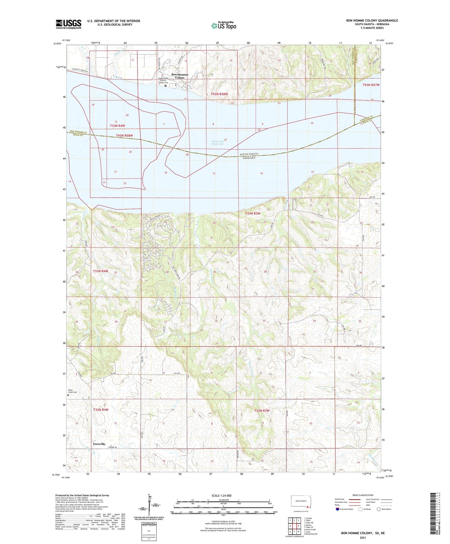
2021 topographic map quadrangle Bon Homme Colony in the states of Nebraska, South Dakota. Scale: 1:24000. Based on the newly updated USGS 7.5' US Topo map series, this map is in the following counties: Bon Homme, Knox, Yankton. The map contains contour data, water features, and other items you are used to seeing on USGS maps, but also has updated roads and other features. This is the next generation of topographic maps. Printed on high-quality waterproof paper with UV fade-resistant inks.
Quads adjacent to this one:
West: Santee
Northwest: Tyndall
North: Tabor
Northeast: Tabor NE
East: Tabor SE
Southeast: Bloomfield NE
South: Lindy
Southwest: Howe Creek
This map covers the same area as the classic USGS quad with code o42097g6.
Contains the following named places: Birdsell Creek, Bloomfield Campground, Bloomfield Recreation Area, Bon Homme Colony, Bon Homme Colony Census Designated Place, Charley Creek, Charley Creek Recreation Area, Cook Creek, Devils Nest Creek, Devils Nest Recreation Area, Grimm Farm Airport, Harm Ranch Airfield, Hobu Creek Cemetery, Hutterische Church Colony Cemetery, Hutterische Colony Elementary School, Lewis and Clark Lake, Miller Creek Campground, Miller Creek Recreation Area, Tabor Recreation Area, Tewsville, Township of Herrick