MyTopo
Malmo NW Nebraska US Topo Map
Couldn't load pickup availability
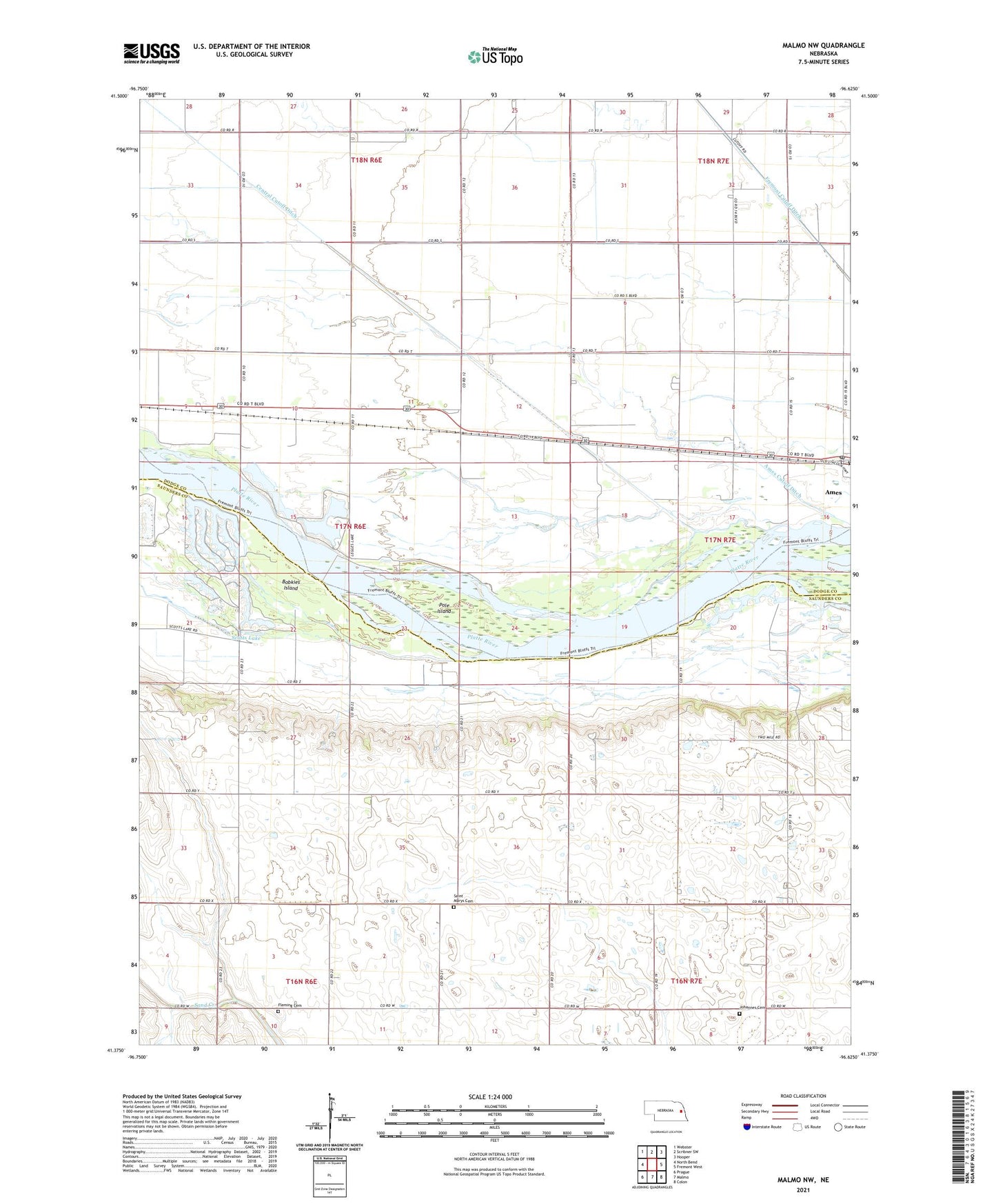
2021 topographic map quadrangle Malmo NW in the state of Nebraska. Scale: 1:24000. Based on the newly updated USGS 7.5' US Topo map series, this map is in the following counties: Saunders, Dodge. The map contains contour data, water features, and other items you are used to seeing on USGS maps, but also has updated roads and other features. This is the next generation of topographic maps. Printed on high-quality waterproof paper with UV fade-resistant inks.
Quads adjacent to this one:
West: North Bend
Northwest: Webster
North: Scribner SW
Northeast: Hooper
East: Fremont West
Southeast: Colon
South: Malmo
Southwest: Prague
Contains the following named places: Ames, Ames Census Designated Place, Ames Cutoff Ditch, Ames Post Office - CPO, Bobkies Island, Bramble State Wildlife Management Area, Central Cutoff Ditch, Eason Lake, Fleming Cemetery, Fremont Cutoff Ditch, Johannes Cemetery, Legge Lake, Pole Island, Saint Marys Cemetery, School Number 43, School Number 91, Scotts Lake, Township of Morse Bluff, Wolf Lakes, ZIP Codes: 68015, 68621