MyTopo
Manley Nebraska US Topo Map
Couldn't load pickup availability
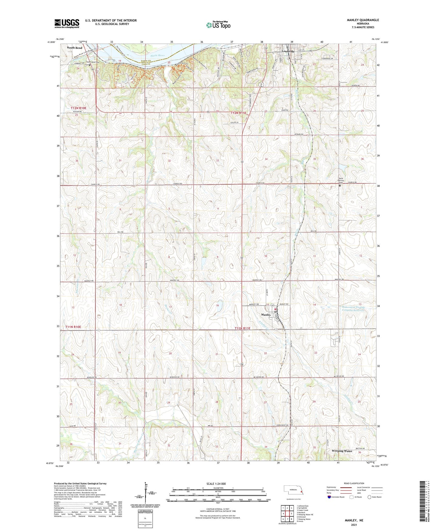
2021 topographic map quadrangle Manley in the state of Nebraska. Scale: 1:24000. Based on the newly updated USGS 7.5' US Topo map series, this map is in the following counties: Cass, Sarpy. The map contains contour data, water features, and other items you are used to seeing on USGS maps, but also has updated roads and other features. This is the next generation of topographic maps. Printed on high-quality waterproof paper with UV fade-resistant inks.
Quads adjacent to this one:
West: Murdock
Northwest: Ashland East
North: Springfield
Northeast: Cedar Creek
East: Weeping Water NE
Southeast: Avoca
South: Weeping Water
Southwest: Elmwood
This map covers the same area as the classic USGS quad with code o40096h2.
Contains the following named places: Camp Harding, Camp Kitaki, Camp Newman, Cass County, Cass County Emergency Management Agency, Center Election Precinct, City of Louisville, College Hill School, Decker Creek, Dutch School, Emmanuel Church, First Christian Church, Greenwood Farmers Cooperative Elevator, Immanuel Church, Louisville, Louisville Care Center, Louisville Election Precinct, Louisville Lakes State Recreation Area, Luetchens Dam, Luetchens Reservoir, Manley, Manley Post Office, Manley Public School, Manley Volunteer Fire Department, Midwestern Feeding Company Reservoir, Midwestern Feedlot Retention Dam, Mill Creek, Platte River State Park, Platte River State Park Trails, Saint Patricks Catholic Church, Saint Patricks Cemetery, Saint Patricks Cemetery Historical Marker, Township of Center, Township of Louisville, Village of Manley, ZIP Codes: 68037, 68403, 68463