MyTopo
Menominee Nebraska US Topo Map
Couldn't load pickup availability
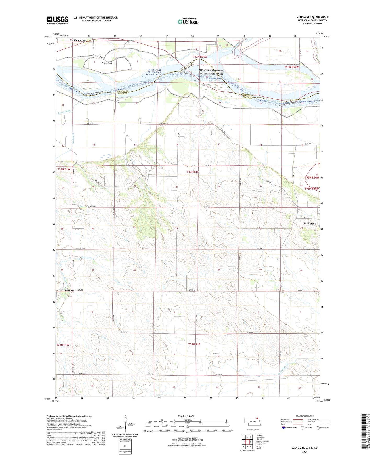
2021 topographic map quadrangle Menominee in the states of Nebraska, South Dakota. Scale: 1:24000. Based on the newly updated USGS 7.5' US Topo map series, this map is in the following counties: Cedar, Yankton. The map contains contour data, water features, and other items you are used to seeing on USGS maps, but also has updated roads and other features. This is the next generation of topographic maps. Printed on high-quality waterproof paper with UV fade-resistant inks.
Quads adjacent to this one:
West: Gavins Point Dam
Northwest: Yankton
North: Mission Hill
Northeast: Gayville
East: Saint Helena
Southeast: Wynot
South: Fordyce
Southwest: Crofton
Contains the following named places: Antelope Creek, Election Precinct 1, James River, Joy Hill School, Menominee, Menominee Post Office, Precinct One, Rush Island, Saint Helena Chapel, Schremp School, Sunny Side School, ZIP Code: 68774