MyTopo
Naper Nebraska US Topo Map
Couldn't load pickup availability
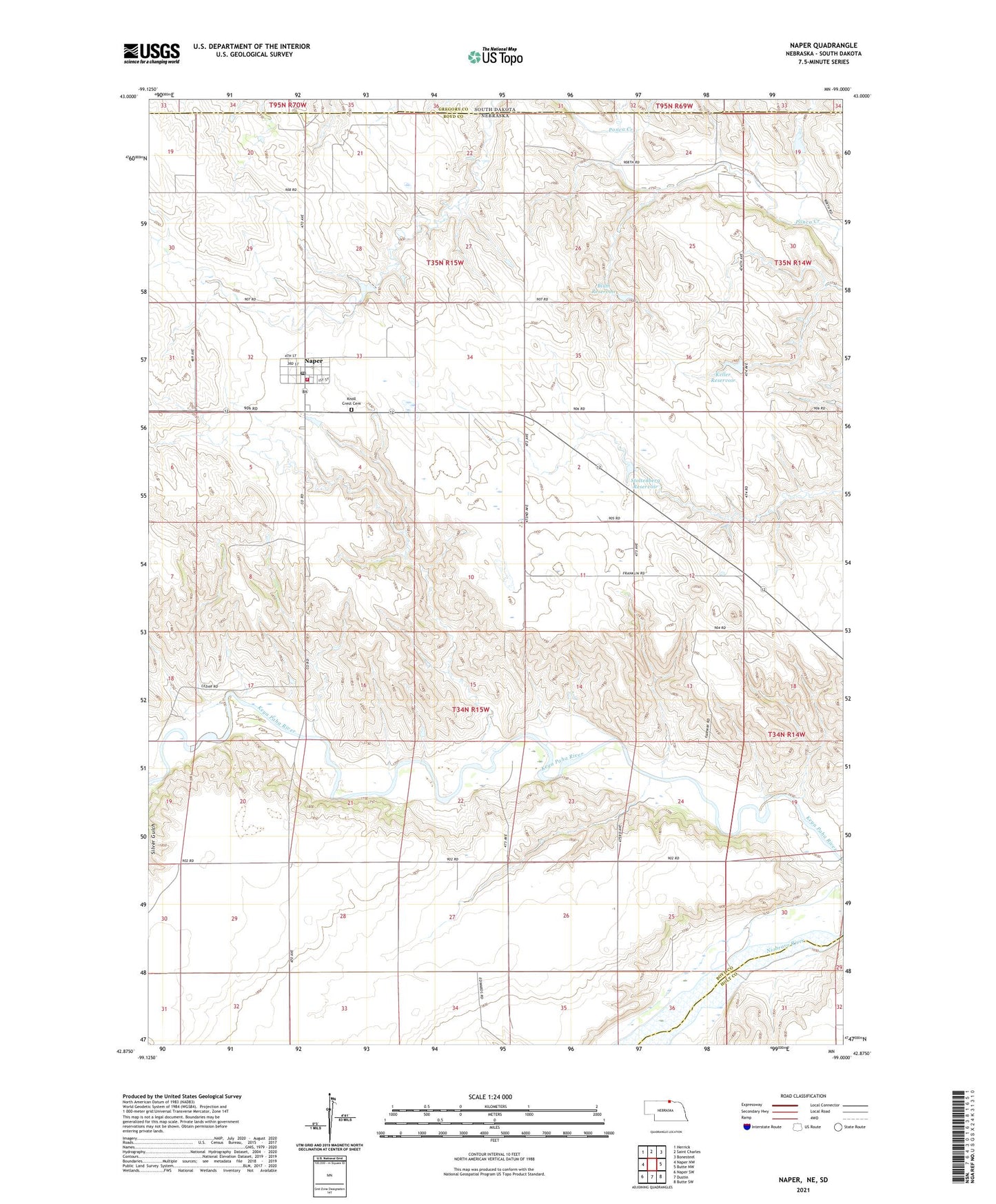
2021 topographic map quadrangle Naper in the state of Nebraska. Scale: 1:24000. Based on the newly updated USGS 7.5' US Topo map series, this map is in the following counties: Boyd, Holt, Gregory. The map contains contour data, water features, and other items you are used to seeing on USGS maps, but also has updated roads and other features. This is the next generation of topographic maps. Printed on high-quality waterproof paper with UV fade-resistant inks.
Quads adjacent to this one:
West: Naper NW
Northwest: Herrick
North: Saint Charles
Northeast: Bonesteel
East: Butte NW
Southeast: Butte SW
South: Dustin
Southwest: Naper SW
Contains the following named places: Basin Post Office, Basin School, Blum Dam, Blum Reservoir, Dry Creek, Keller Dam, Keller Reservoir, Knoll Crest Cemetery, Mount Zion School, Naper, Naper Elementary School, Naper Medical Clinic, Naper Post Office, Naper Volunteer Fire Department, Point School, Saint Pauls Lutheran Church, School Number 22, School Number 54, Stoltenberg Dam, Stoltenberg Reservoir, Sunnyside School, Village of Naper, White Horse Ranch