MyTopo
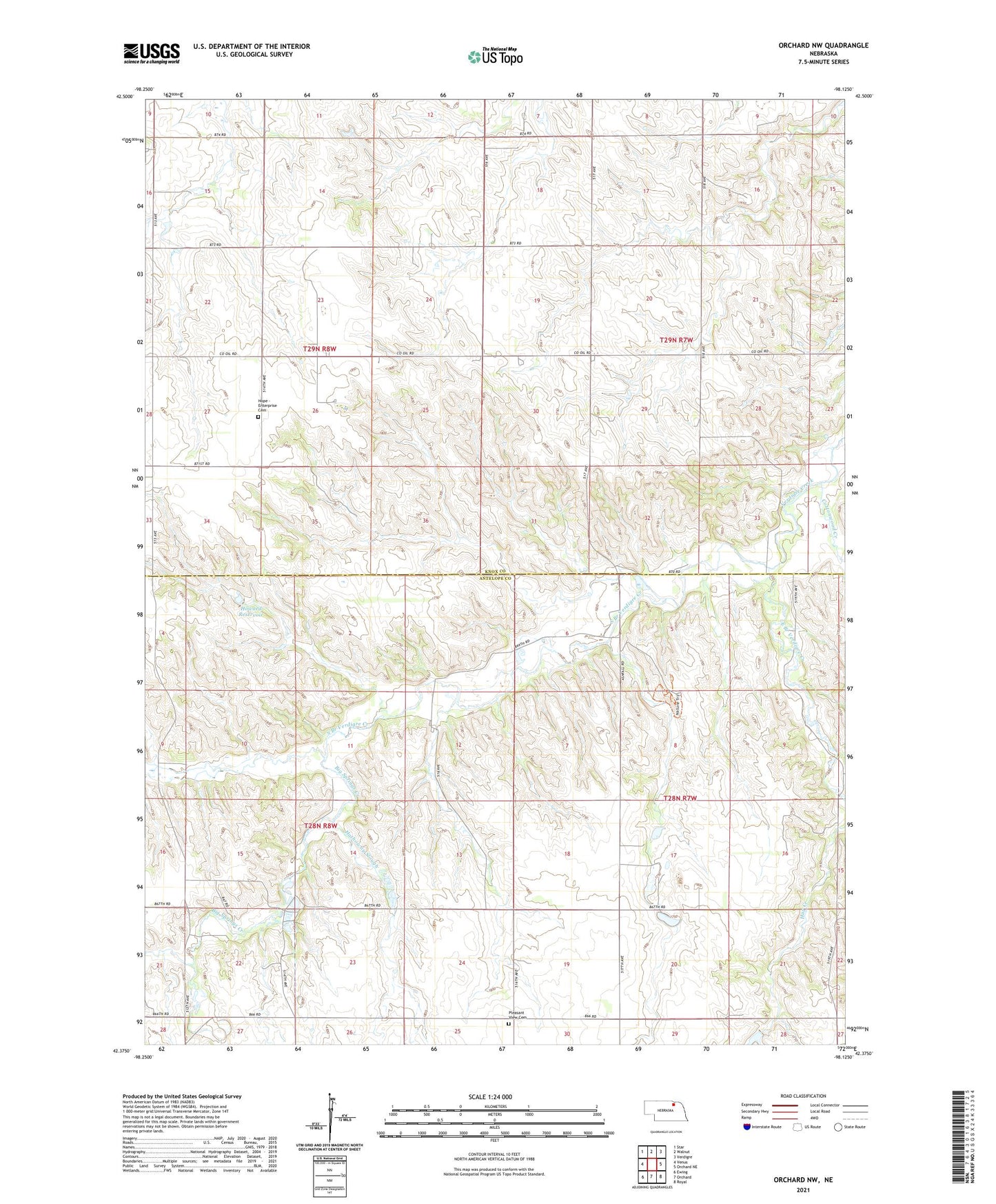
Orchard NW Nebraska US Topo Map
Couldn't load pickup availability
2021 topographic map quadrangle Orchard NW in the state of Nebraska. Scale: 1:24000. Based on the newly updated USGS 7.5' US Topo map series, this map is in the following counties: Knox, Antelope. The map contains contour data, water features, and other items you are used to seeing on USGS maps, but also has updated roads and other features. This is the next generation of topographic maps. Printed on high-quality waterproof paper with UV fade-resistant inks.
Quads adjacent to this one:
West: Venus
Northwest: Star
North: Walnut
Northeast: Verdigre
East: Orchard NE
Southeast: Royal
South: Orchard
Southwest: Ewing
Contains the following named places: Ashfall Fossil Beds State Historical Park, Ashfall Trail, Big Springs Creek, Cottonwood Creek, Hathoway Slough, Hope - Enterprise Cemetery, Howard Dam, Howard Reservoir, O and W Dairy Farms, Pleasant Hill School, Pleasant View Cemetery, South Branch Verdigre Creek, Township of Logan, Township of Sherman, Township of Verdigris, ZIP Code: 68764