MyTopo
Elm Creek West Nebraska US Topo Map
Couldn't load pickup availability
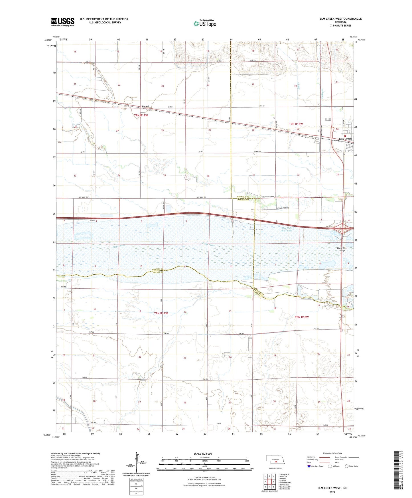
2021 topographic map quadrangle Elm Creek West in the state of Nebraska. Scale: 1:24000. Based on the newly updated USGS 7.5' US Topo map series, this map is in the following counties: Dawson, Phelps, Buffalo. The map contains contour data, water features, and other items you are used to seeing on USGS maps, but also has updated roads and other features. This is the next generation of topographic maps. Printed on high-quality waterproof paper with UV fade-resistant inks.
Quads adjacent to this one:
West: Overton
Northwest: Lexington SE
North: Miller SW
Northeast: Amherst
East: Elm Creek East
Southeast: Elm Creek SE
South: Elm Creek SW
Southwest: Bertrand SE
This map covers the same area as the classic USGS quad with code o40099f4.
Contains the following named places: Blue Hole West Lake, East Twelfth School, Elm Creek Canal, Elm Creek Volunteer Fire and Rescue Department, Historic Platte Valley Historical Marker, Platte River Bridge, School Number 3, School Number 94, Township of Overton, Township of Williamsburg, Trued, Village of Elm Creek, Williamsburg Church, Williamsburg Post Office