MyTopo
Prosser Nebraska US Topo Map
Couldn't load pickup availability
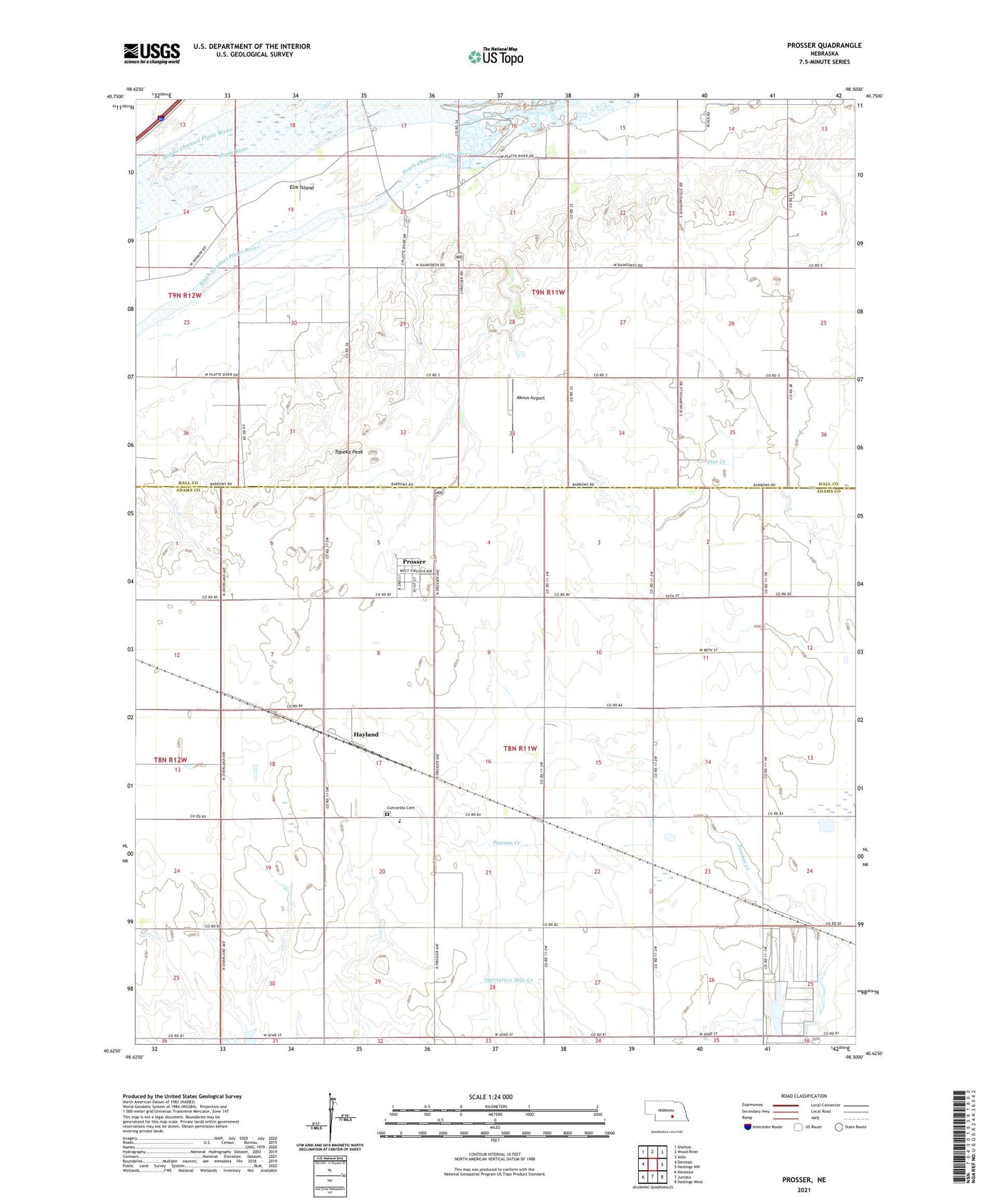
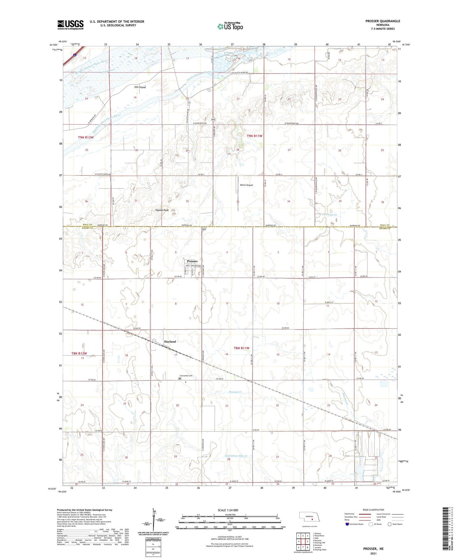
2021 topographic map quadrangle Prosser in the state of Nebraska. Scale: 1:24000. Based on the newly updated USGS 7.5' US Topo map series, this map is in the following counties: Adams, Hall. The map contains contour data, water features, and other items you are used to seeing on USGS maps, but also has updated roads and other features. This is the next generation of topographic maps. Printed on high-quality waterproof paper with UV fade-resistant inks.
Quads adjacent to this one:
West: Denman
Northwest: Shelton
North: Wood River
Northeast: Alda
East: Hastings NW
Southeast: Hastings West
South: Juniata
Southwest: Kenesaw
This map covers the same area as the classic USGS quad with code o40098f5.
Contains the following named places: Aknux Airport, Concordia Cemetery, Hayland, Hayland Post Office, Juniata Feedyard, KRGI-FM (Grand Island), Prosser, Prosser Post Office, Rising Star Public School, School Number 87, Topeka Peak, Township of Martin, Township of Verona, Village of Prosser