MyTopo
Juniata Nebraska US Topo Map
Couldn't load pickup availability
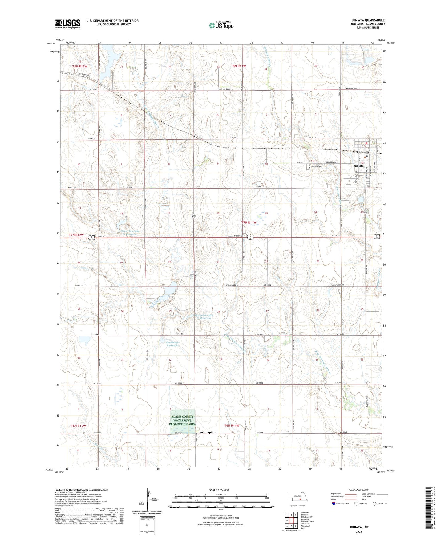
2021 topographic map quadrangle Juniata in the state of Nebraska. Scale: 1:24000. Based on the newly updated USGS 7.5' US Topo map series, this map is in the following counties: Adams. The map contains contour data, water features, and other items you are used to seeing on USGS maps, but also has updated roads and other features. This is the next generation of topographic maps. Printed on high-quality waterproof paper with UV fade-resistant inks.
Quads adjacent to this one:
West: Kenesaw
Northwest: Denman
North: Prosser
Northeast: Hastings NW
East: Hastings West
Southeast: Ayr
South: Roseland
Southwest: Holstein
This map covers the same area as the classic USGS quad with code o40098e5.
Contains the following named places: Adams County, Assumption, Assumption Catholic Church, Christ Lutheran Church, Christ Lutheran School, Detention Dam C, Detention Dam D, Detention Dam E, Flood Retarding Dam K, Heartland Co-op Elevator, Juniata, Juniata Cemetery, Juniata Elementary School, Juniata Post Office, Juniata Rural Fire District, Oregon Trail Historical Marker, Roseland Assumption School, Roseland Lake, Roseland Lake Campground, Thirty-Two Mile Creek Reservoir, Thirty-Two Mile Reservoir D, Township of Juniata, United Methodist Church, Vieselmeyer Dam, Vieselmeyer Reservoir, Village of Juniata, ZIP Code: 68955