MyTopo
Elm Creek East Nebraska US Topo Map
Couldn't load pickup availability
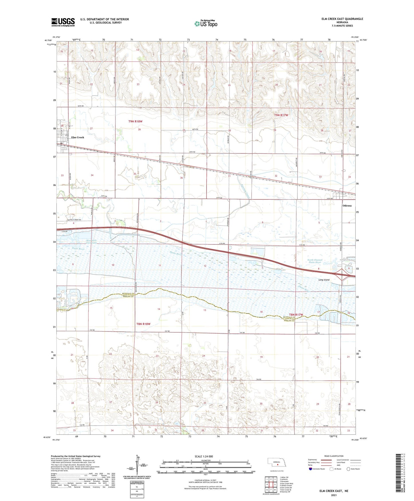
2021 topographic map quadrangle Elm Creek East in the state of Nebraska. Scale: 1:24000. Based on the newly updated USGS 7.5' US Topo map series, this map is in the following counties: Buffalo, Phelps. The map contains contour data, water features, and other items you are used to seeing on USGS maps, but also has updated roads and other features. This is the next generation of topographic maps. Printed on high-quality waterproof paper with UV fade-resistant inks.
Quads adjacent to this one:
West: Elm Creek West
Northwest: Miller SW
North: Amherst
Northeast: Riverdale
East: Alfalfa Center
Southeast: Kearney SW
South: Elm Creek SE
Southwest: Elm Creek SW
This map covers the same area as the classic USGS quad with code o40099f3.
Contains the following named places: Blue Hole East Lake, Blue Hole State Wildlife Management Area, Buffalo Creek, Election Precinct 25, Elm Creek, Elm Creek Historical Marker, Elm Creek Post Office, Elm Creek Public Library, Elm Creek Public Schools, Immaculate Conception Catholic Church, Kearney Diversion Dam, Kearney Diversion Dam Reservoir, Lakeside RV Park, Odessa, Odessa Census Designated Place, Odessa Post Office, Odessa Public School, Sandy Channel State Recreation Area, South Channel Platte River, Township of Cottonwood, Township of Elm Creek, Township of Odessa, Union Pacific Campground, Union Pacific State Recreation Area, ZIP Codes: 68836, 68861