MyTopo
Scribner Nebraska US Topo Map
Couldn't load pickup availability
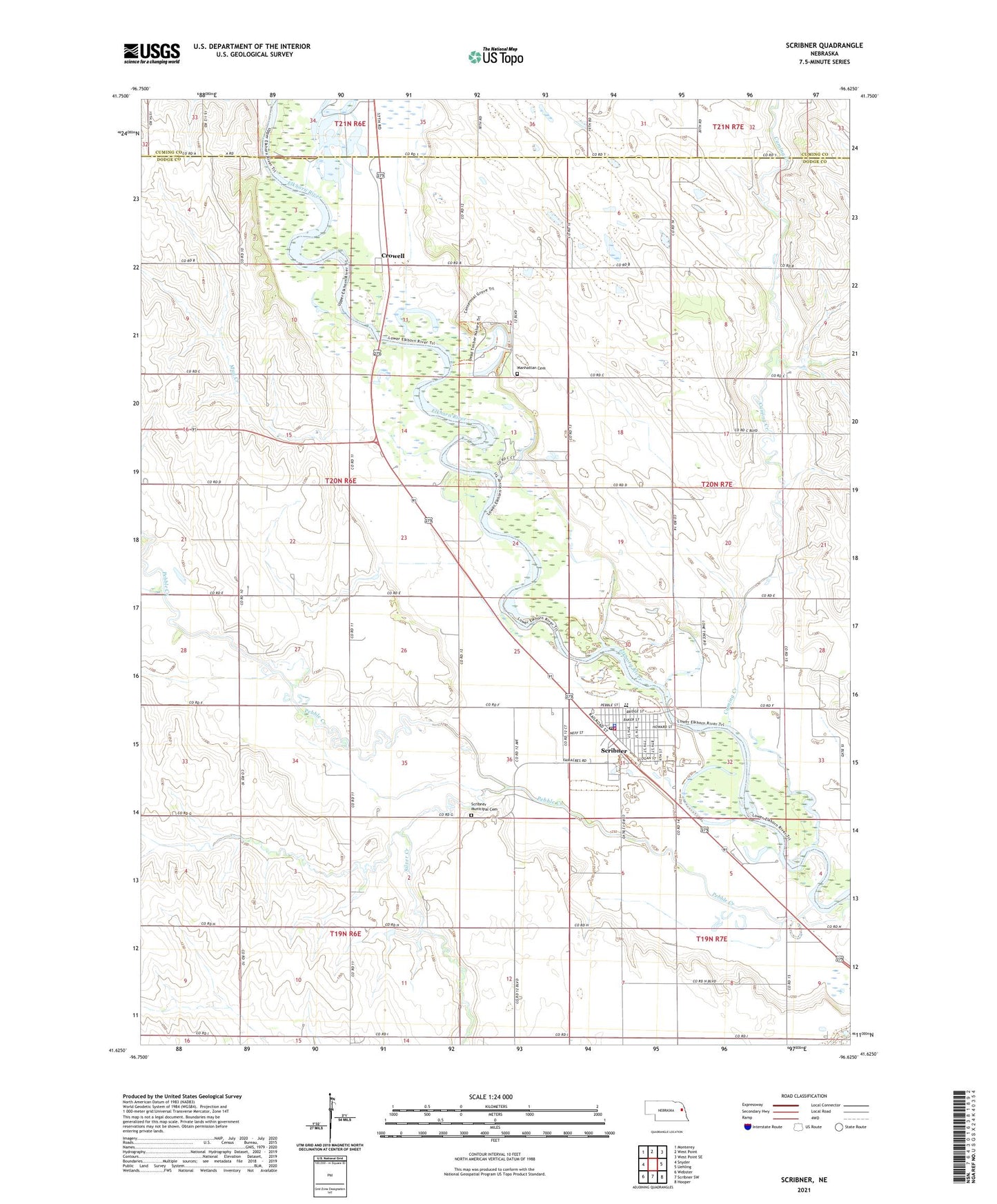
2021 topographic map quadrangle Scribner in the state of Nebraska. Scale: 1:24000. Based on the newly updated USGS 7.5' US Topo map series, this map is in the following counties: Dodge, Cuming. The map contains contour data, water features, and other items you are used to seeing on USGS maps, but also has updated roads and other features. This is the next generation of topographic maps. Printed on high-quality waterproof paper with UV fade-resistant inks.
Quads adjacent to this one:
West: Snyder
Northwest: Monterey
North: West Point
Northeast: West Point SE
East: Uehling
Southeast: Hooper
South: Scribner SW
Southwest: Webster
Contains the following named places: City of Scribner, Crowell, Crowell Post Office, Cuming Creek, Dead Timber State Recreation Area, Dodge County Fairgrounds, Drahota Dental Associates Center, Fairgrounds Park, Good Samaritan Center, Manhattan Cemetery, Mud Creek, Musbach Museum, Pebble Creek, Powder Horn State Wildlife Management Area, Saint Lawrence Catholic Church, Saint Peters Lutheran Church, School Number 24, School Number 25, School Number 36, School Number 50, Scribner, Scribner City Park, Scribner Medical Clinic, Scribner Municipal Cemetery, Scribner Police Department, Scribner Post Office, Scribner Public Library, Scribner Volunteer Fire and Rescue, Scribner-Snyder Community Schools, Silver Creek, Township of Pebble, Trinity Church, United Church of Christ, United Evangelical Lutheran Church, ZIP Code: 68057