MyTopo
Pilger Nebraska US Topo Map
Couldn't load pickup availability
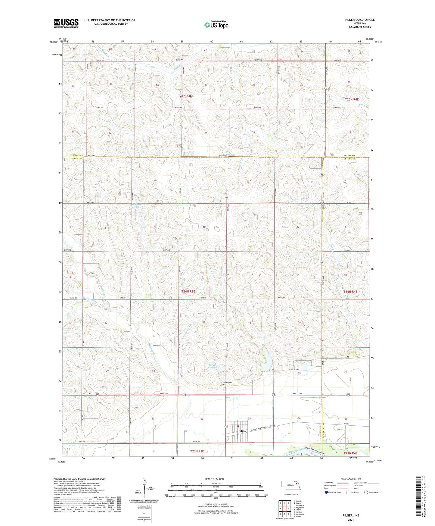
2021 topographic map quadrangle Pilger in the state of Nebraska. Scale: 1:24000. Based on the newly updated USGS 7.5' US Topo map series, this map is in the following counties: Stanton, Wayne, Cuming. The map contains contour data, water features, and other items you are used to seeing on USGS maps, but also has updated roads and other features. This is the next generation of topographic maps. Printed on high-quality waterproof paper with UV fade-resistant inks.
Quads adjacent to this one:
West: Wayne SW
Northwest: Winside
North: Wayne
Northeast: Altona NW
East: Altona
Southeast: Wisner
South: Stanton NE
Southwest: Stanton
This map covers the same area as the classic USGS quad with code o42097a1.
Contains the following named places: Black Island State Wildlife Management Area, Bordner Dam, Bordner Reservoir, Farmers Cooperative Elevator, Pilger, Pilger Cemetery, Pilger Detention Dam 1-B, Pilger Election Precinct, Pilger Elementary School, Pilger Post Office, Pilger Public Library, Pilger Reservoir 1-B, Pilger State Recreation Area, Pilger Volunteer Fire Department, Saint Johns Lutheran Church, Saint Peters Lutheran Church, School Number 18, School Number 23, School Number 25, School Number 43, School Number 7, South Branch Humbug Creek, Stanton County Historical Marker, Stanton County Museum, Township of Pilger, United Methodist Church, Village of Pilger, Willers Dam, Willers Reservoir