MyTopo
Venus Nebraska US Topo Map
Couldn't load pickup availability
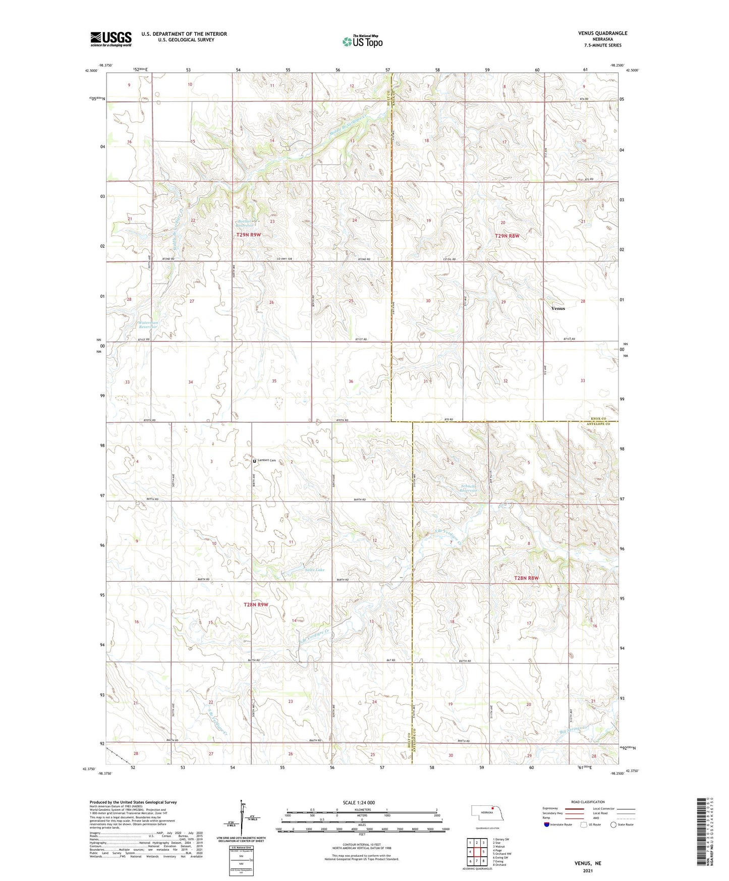
2021 topographic map quadrangle Venus in the state of Nebraska. Scale: 1:24000. Based on the newly updated USGS 7.5' US Topo map series, this map is in the following counties: Holt, Knox, Antelope. The map contains contour data, water features, and other items you are used to seeing on USGS maps, but also has updated roads and other features. This is the next generation of topographic maps. Printed on high-quality waterproof paper with UV fade-resistant inks.
Quads adjacent to this one:
West: Page
Northwest: Dorsey SW
North: Star
Northeast: Walnut
East: Orchard NW
Southeast: Orchard
South: Ewing
Southwest: Ewing SW
Contains the following named places: Boelter Dam, Boelter Reservoir, Cream Ridge School, Cronk Dam, Lambert Cemetery, Saltz Lake, Schacht Dam, Schacht Reservoir, School Number 30, School Number 55, Township of Iowa, Venus, Venus Post Office, Venus School, Venus Wesleyan Church, Waterman Dam, Waterman Reservoir