MyTopo
Weeping Water NE Nebraska US Topo Map
Couldn't load pickup availability
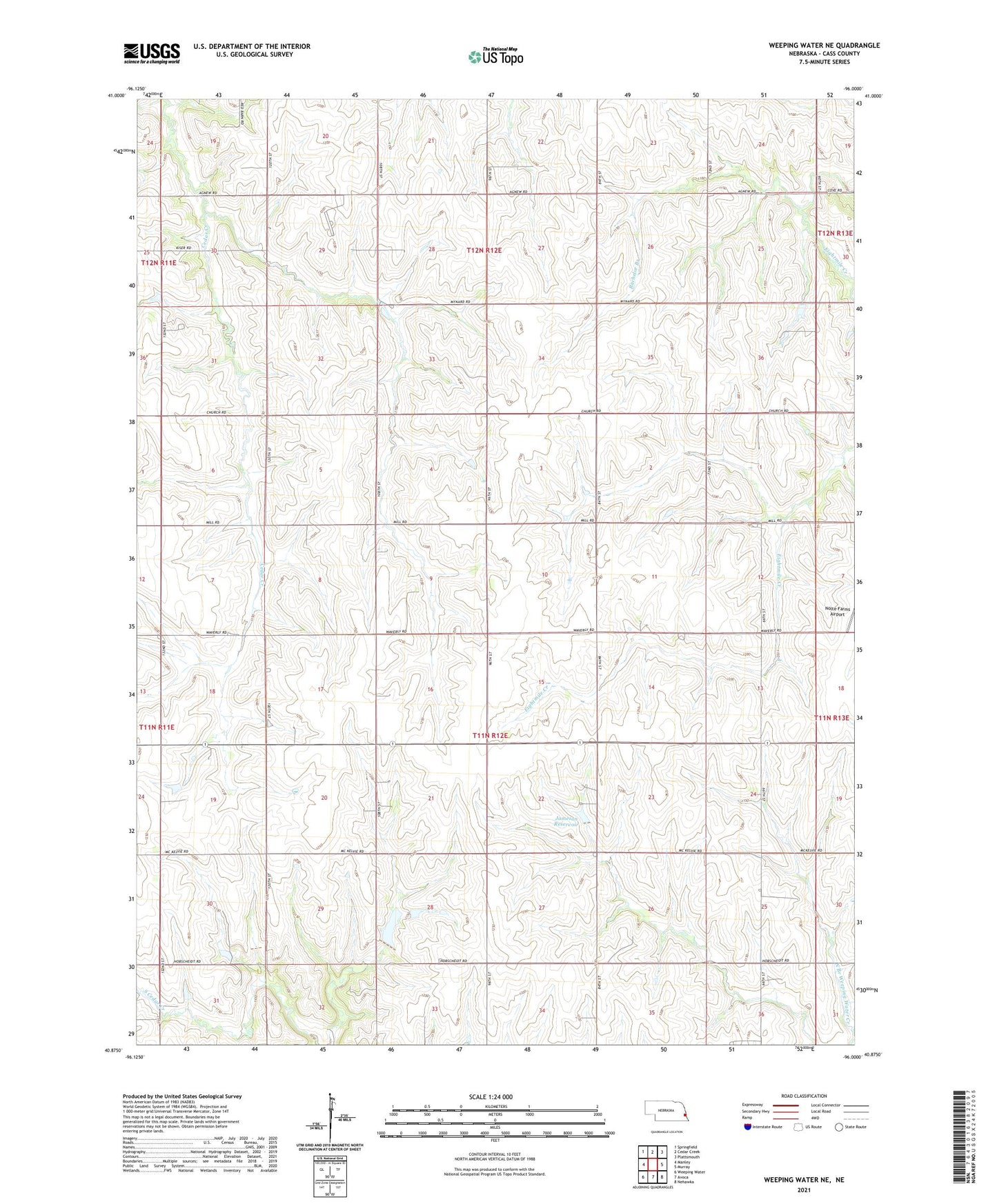
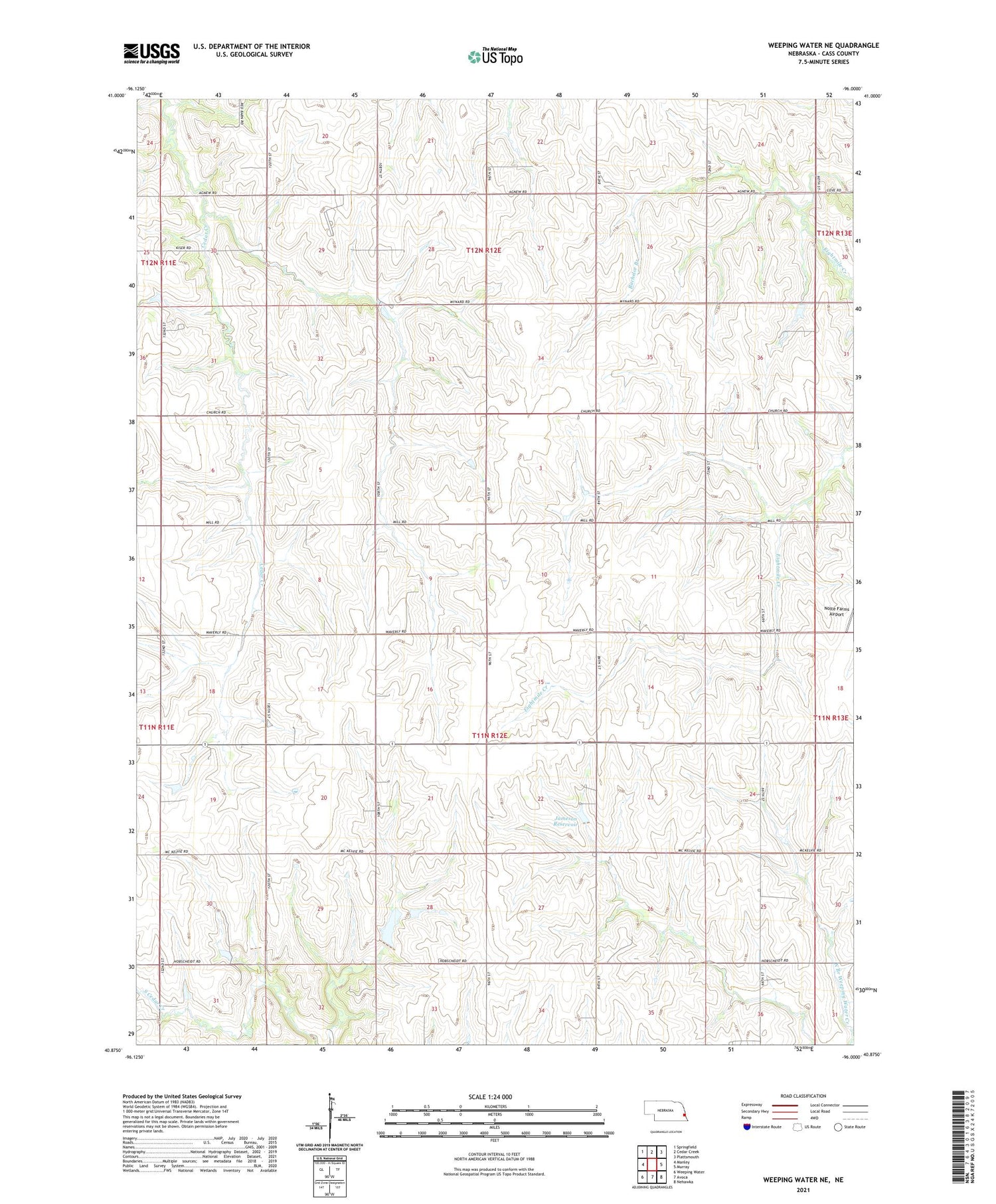
2021 topographic map quadrangle Weeping Water NE in the state of Nebraska. Scale: 1:24000. Based on the newly updated USGS 7.5' US Topo map series, this map is in the following counties: Cass. The map contains contour data, water features, and other items you are used to seeing on USGS maps, but also has updated roads and other features. This is the next generation of topographic maps. Printed on high-quality waterproof paper with UV fade-resistant inks.
Quads adjacent to this one:
West: Manley
Northwest: Springfield
North: Cedar Creek
Northeast: Plattsmouth
East: Murray
Southeast: Nehawka
South: Avoca
Southwest: Weeping Water
Contains the following named places: Bachelor Branch, Fairview School, Glendale Post Office, Glendale School, Jameson Dam, Jameson Reservoir, Mount Pleasant Election Precinct, Oxford School, Pleasant Hill School, Pleasant View School, Sunnyside School, Township of Eight Mile Grove, Township of Mount Pleasant, Township of Plattsmouth