MyTopo
Western SE Nebraska US Topo Map
Couldn't load pickup availability
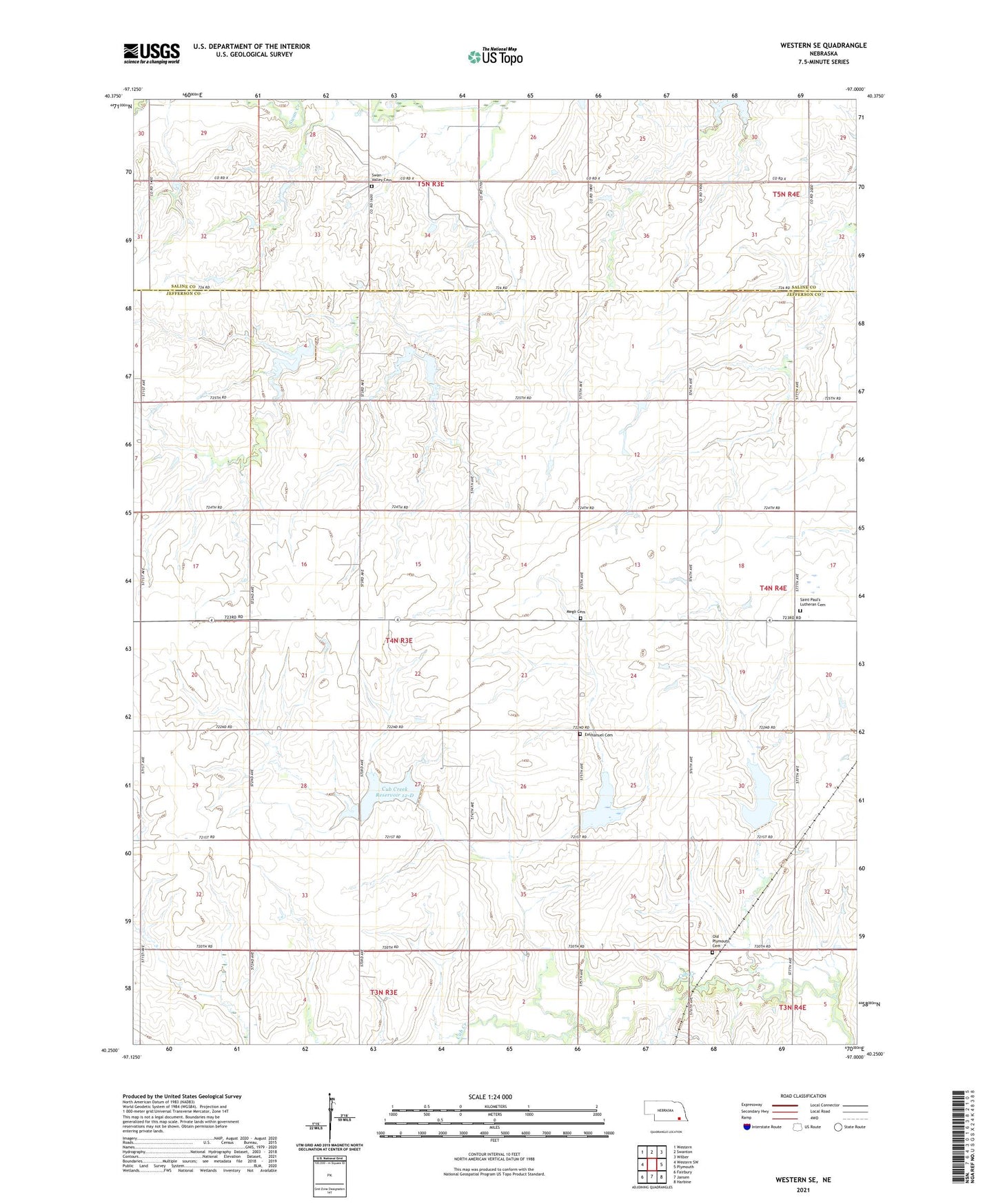
2021 topographic map quadrangle Western SE in the state of Nebraska. Scale: 1:24000. Based on the newly updated USGS 7.5' US Topo map series, this map is in the following counties: Jefferson, Saline. The map contains contour data, water features, and other items you are used to seeing on USGS maps, but also has updated roads and other features. This is the next generation of topographic maps. Printed on high-quality waterproof paper with UV fade-resistant inks.
Quads adjacent to this one:
West: Western SW
Northwest: Western
North: Swanton
Northeast: Wilber
East: Plymouth
Southeast: Harbine
South: Jansen
Southwest: Fairbury
Contains the following named places: Cub Creek Dam 12-D, Cub Creek Reservoir 10-A, Cub Creek Reservoir 12-C, Cub Creek Reservoir 12-D, Emmanuel Cemetery, Floodwater Retarding Dam 10-A, Floodwater Retarding Dam 12-C, Gibson Election Precinct, Megli Cemetery, Old Plymouth Cemetery, Peace Church, Prairie Lawn School, Saint Paul's Lutheran Cemetery, School Number 17, Swan Valley Cemetery, Township of Gibson, ZIP Code: 68424