MyTopo
York North Nebraska US Topo Map
Couldn't load pickup availability
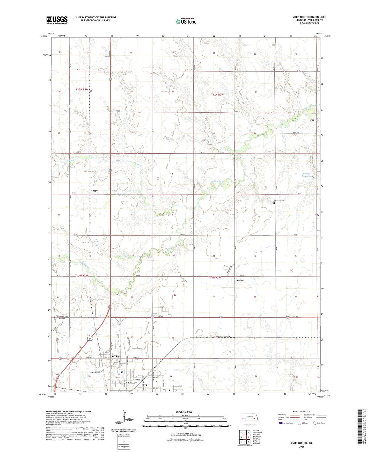
2021 topographic map quadrangle York North in the state of Nebraska. Scale: 1:24000. Based on the newly updated USGS 7.5' US Topo map series, this map is in the following counties: York. The map contains contour data, water features, and other items you are used to seeing on USGS maps, but also has updated roads and other features. This is the next generation of topographic maps. Printed on high-quality waterproof paper with UV fade-resistant inks.
Quads adjacent to this one:
West: Bradshaw
Northwest: Durant
North: Stromsburg
Northeast: Gresham
East: Waco
Southeast: Utica SW
South: York South
Southwest: York SW
Contains the following named places: Arbor Drive Baptist Church, Coon Branch, Duke Park, Edison School, First Christian Church, Houston, Houston Post Office, Jehovah Witnesses Church, Mapps, Miller Park, Nebraska 4-H Clubs Began in York County Historical Marker, New York Election Precinct, Rosemond Cemetery, Saint Pauls Church, Seventh Day Adventist Church, Specialty Clinic West, The Hearthstone, Township of New York, Wessels Dam, Wessels Reservoir, Y Motel and RV Park, York County Fairgrounds, York Elementary School, York Feedlot, York General Hospital, York High School, York Medical Clinic, York Municipal Airport, Zion Cemetery, Zion Church