MyTopo
Alder Creek Ranch Nevada US Topo Map
Couldn't load pickup availability
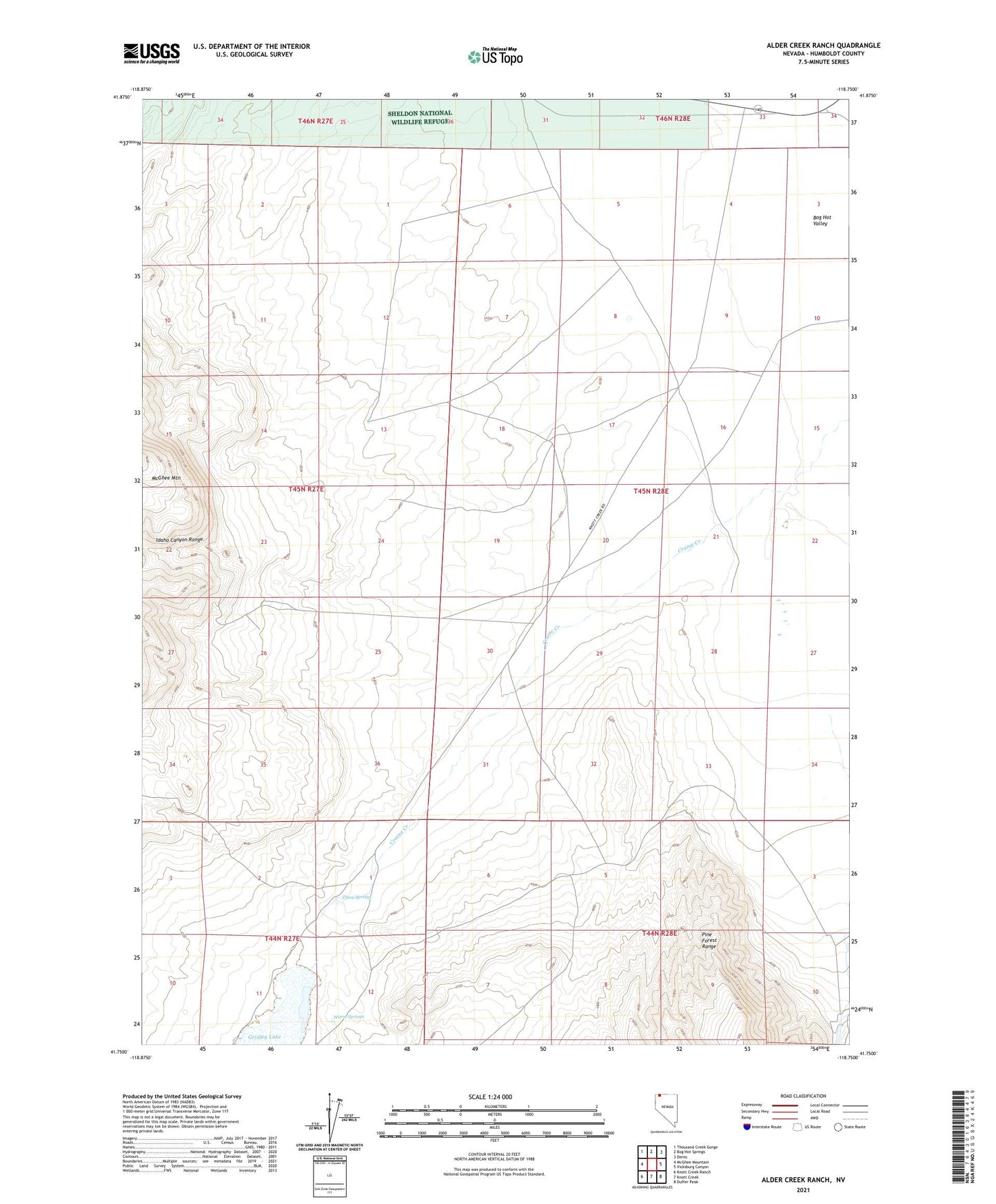
2021 topographic map quadrangle Alder Creek Ranch in the state of Nevada. Scale: 1:24000. Based on the newly updated USGS 7.5' US Topo map series, this map is in the following counties: Humboldt. The map contains contour data, water features, and other items you are used to seeing on USGS maps, but also has updated roads and other features. This is the next generation of topographic maps. Printed on high-quality waterproof paper with UV fade-resistant inks.
Quads adjacent to this one:
West: McGhee Mountain
Northwest: Thousand Creek Gorge
North: Bog Hot Springs
Northeast: Denio
East: Vicksburg Canyon
Southeast: Duffer Peak
South: Knott Creek
Southwest: Knott Creek Ranch
This map covers the same area as the classic USGS quad with code o41118g7.
Contains the following named places: Alder Creek Ranch, Bog Hot Well, Giliotti Well, Gridley Lake, Painted Hills Mine, Three Springs, Warm Springs