MyTopo
Vicksburg Canyon Nevada US Topo Map
Couldn't load pickup availability
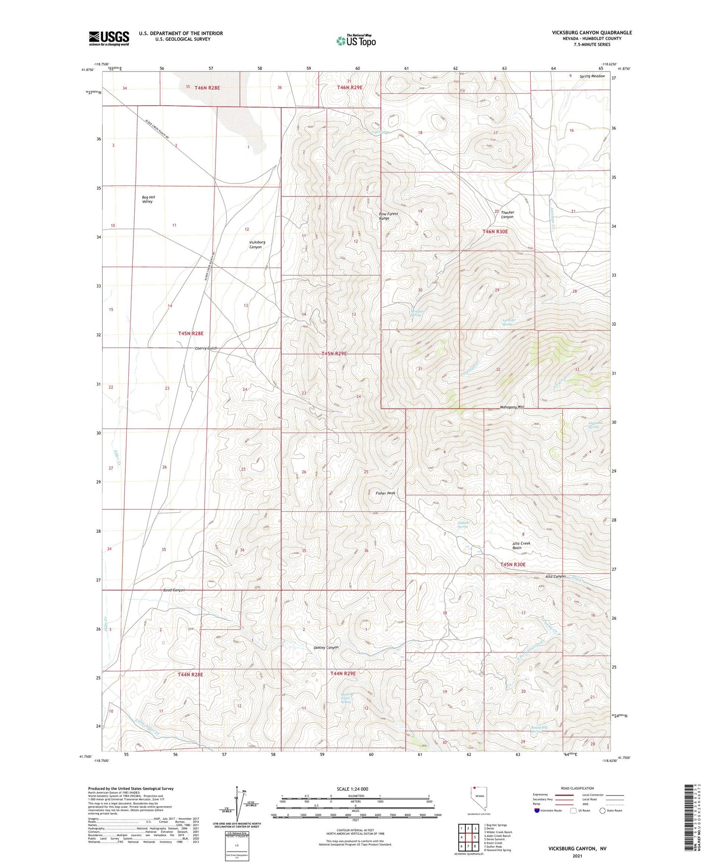
2021 topographic map quadrangle Vicksburg Canyon in the state of Nevada. Scale: 1:24000. Based on the newly updated USGS 7.5' US Topo map series, this map is in the following counties: Humboldt. The map contains contour data, water features, and other items you are used to seeing on USGS maps, but also has updated roads and other features. This is the next generation of topographic maps. Printed on high-quality waterproof paper with UV fade-resistant inks.
Quads adjacent to this one:
West: Alder Creek Ranch
Northwest: Bog Hot Springs
North: Denio
Northeast: Wilder Creek Ranch
East: Denio Summit
Southeast: Howard Hot Spring
South: Duffer Peak
Southwest: Knott Creek
This map covers the same area as the classic USGS quad with code o41118g6.
Contains the following named places: Alder Creek, Alta Creek Basin, Antelope Spring, Ashdown Mine, Ashdown Post Office, Bog Hot Valley, Cherry Gulch, Cherry Gulch Mine, Cold Spring, Craine Creek, Defense Mine, Diamond Spring, Fisher Peak, Hillside Spring, Little Alder Creek, Mahogany Mountain, Mosquito Spring, Oakley Canyon, Pueblo Mill, Quaking Aspen Spring, Road Canyon, Round Hill Spring, South Fork Granite Creek, Thacker Canyon, Vicksburg, Vicksburg Canyon