MyTopo
Arch Canyon Nevada US Topo Map
Couldn't load pickup availability
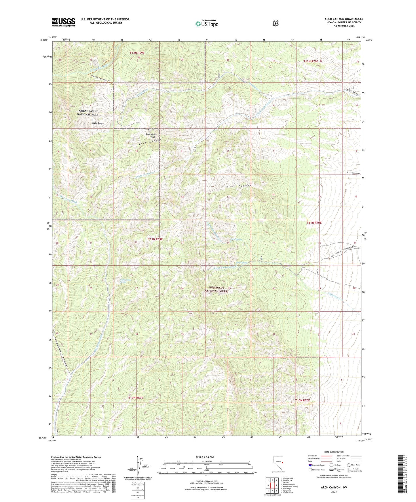
2021 topographic map quadrangle Arch Canyon in the state of Nevada. Scale: 1:24000. Based on the newly updated USGS 7.5' US Topo map series, this map is in the following counties: White Pine. The map contains contour data, water features, and other items you are used to seeing on USGS maps, but also has updated roads and other features. This is the next generation of topographic maps. Printed on high-quality waterproof paper with UV fade-resistant inks.
Quads adjacent to this one:
West: Minerva Canyon
Northwest: Wheeler Peak
North: Kious Spring
Northeast: Garrison
East: Needle Point Spring
Southeast: Tweedy Wash
South: Big Springs
Southwest: Red Ledges
Contains the following named places: Arch Canyon, Black Canyon, Bonanzy Mine, Cedar Cabin Spring, Decathon Canyon, Highland Ridge Wilderness, Indian Mine, Lexington Arch, Lexington Mining District, North Fork Chokecherry Creek, North Spring, South Fork Chokecherry Creek, South Fork Lexington Creek, South Spring