MyTopo
Kious Spring Nevada US Topo Map
Couldn't load pickup availability
Also explore the Kious Spring Forest Service Topo of this same quad for updated USFS data
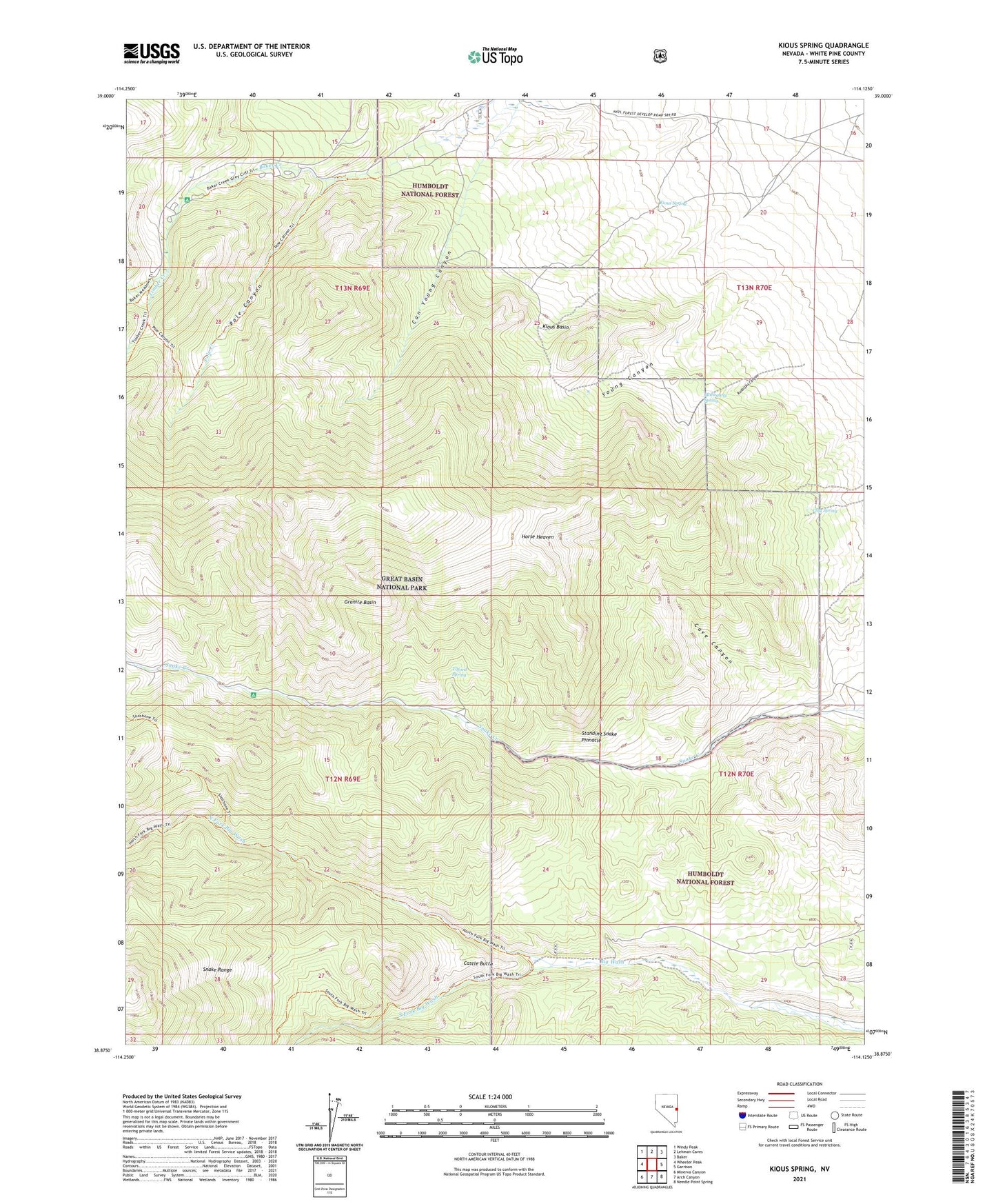
2021 topographic map quadrangle Kious Spring in the state of Nevada. Scale: 1:24000. Based on the newly updated USGS 7.5' US Topo map series, this map is in the following counties: White Pine. The map contains contour data, water features, and other items you are used to seeing on USGS maps, but also has updated roads and other features. This is the next generation of topographic maps. Printed on high-quality waterproof paper with UV fade-resistant inks.
Quads adjacent to this one:
West: Wheeler Peak
Northwest: Windy Peak
North: Lehman Caves
Northeast: Baker
East: Garrison
Southeast: Needle Point Spring
South: Arch Canyon
Southwest: Minerva Canyon
This map covers the same area as the classic USGS quad with code o38114h2.
Contains the following named places: Baker Creek Forest Service Administrative Site, Baker Creek Forest Service Recreation Site, Bonita Mine, Camp Bonita, Can Young Canyon, Castle Butte, Cave Canyon, Clay Spring, Granite Basin, Horse Heaven, Kious Basin, Kious Spring, Mahogany Spring, North Fork Big Wash, Pole Canyon, Pole Creek, Poljack Mine, Rudolphs Canyon, Snake Creek Forest Service Recreation Site, Snake Mining District, South Fork Baker Creek, South Fork Big Wash, Standing Snake Pinnacle, Tilford Spring, Timber Creek, Young Canyon, ZIP Code: 89311