MyTopo
Blanchard Mountain Nevada US Topo Map
Couldn't load pickup availability
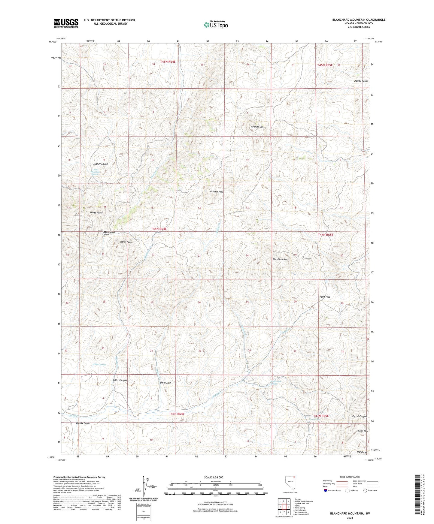
2021 topographic map quadrangle Blanchard Mountain in the state of Nevada. Scale: 1:24000. Based on the newly updated USGS 7.5' US Topo map series, this map is in the following counties: Elko. The map contains contour data, water features, and other items you are used to seeing on USGS maps, but also has updated roads and other features. This is the next generation of topographic maps. Printed on high-quality waterproof paper with UV fade-resistant inks.
Quads adjacent to this one:
West: Henry
Northwest: Contact
North: Middle Stack Mountain
Northeast: Tijuana John Peak
East: Texas Spring
Southeast: Knoll Mountain SE
South: Knoll Mountain
Southwest: Harris Canyon
This map covers the same area as the classic USGS quad with code o41114f6.
Contains the following named places: Agort Pass, Alabama, Apollo Five Mine, Arizona Mine, Babel, Babel Mine, Blanchard Mine, Blanchard Mountain, Bloody Gulch, Bricker Mine, China Mountain Spring, Chinaman Mine, Contact Mining District, Granite Peak, Granite Range, Hanks Creek, Hanks Mine, Hanks Peak, Hice Mine, High Ore Mine, Johnson Mine, Knoll Creek Experimental Station - University of Nevada, Knoll Creek Springs, Lower Alabama, Miller Canyon, Noh Springs, Ohio Gulch, Quilici Creek, Rose O'Connell Mine, Silver Star Mine, Turo Mine, Valder Creek, Vulcan Mine, War Eagle Mine, White Peaks, Willow Spring