MyTopo
Henry Nevada US Topo Map
Couldn't load pickup availability
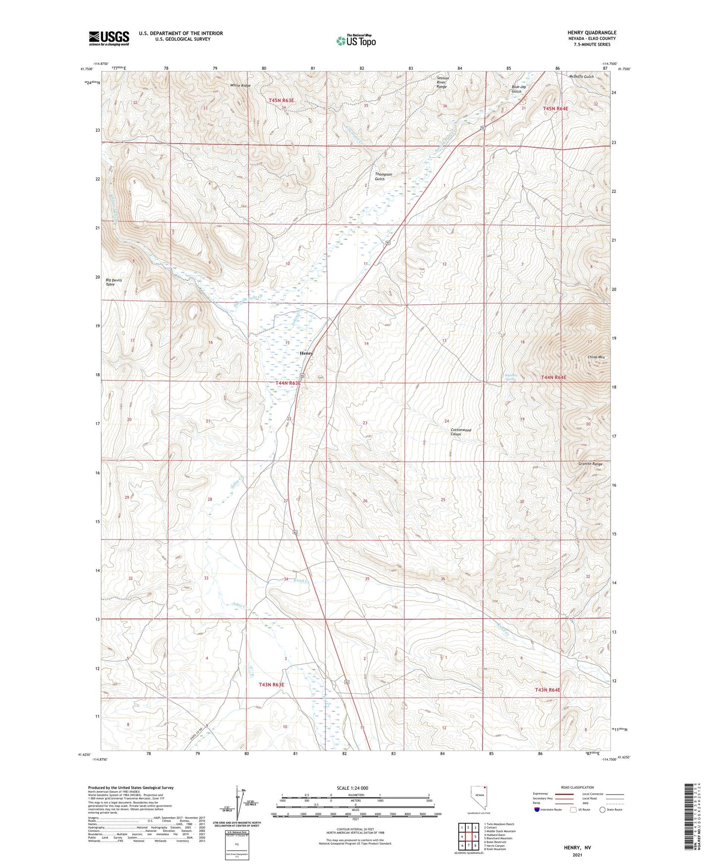
2021 topographic map quadrangle Henry in the state of Nevada. Scale: 1:24000. Based on the newly updated USGS 7.5' US Topo map series, this map is in the following counties: Elko. The map contains contour data, water features, and other items you are used to seeing on USGS maps, but also has updated roads and other features. This is the next generation of topographic maps. Printed on high-quality waterproof paper with UV fade-resistant inks.
Quads adjacent to this one:
West: Hubbard Basin
Northwest: Twin Meadows Ranch
North: Contact
Northeast: Middle Stack Mountain
East: Blanchard Mountain
Southeast: Knoll Mountain
South: Harris Canyon
Southwest: Boies Reservoir
This map covers the same area as the classic USGS quad with code o41114f7.
Contains the following named places: Blue Jay Creek, Blue Jay Gulch, Boies Ranch, China Mountain, Cottonwood Canon, Dry Creek, Headgate Dam, Henry, Hubbard, Hubbard Ranch, Ivy Wilson Mine, Jakes Creek, Knoll Creek, McDuffy Gulch, Riverside, Riverside Depot, Sagehen Spring, Thompson Gulch, Townsend Creek, Vineyard Ranch, White Ridge