MyTopo
Schoolmarm Basin Nevada US Topo Map
Couldn't load pickup availability
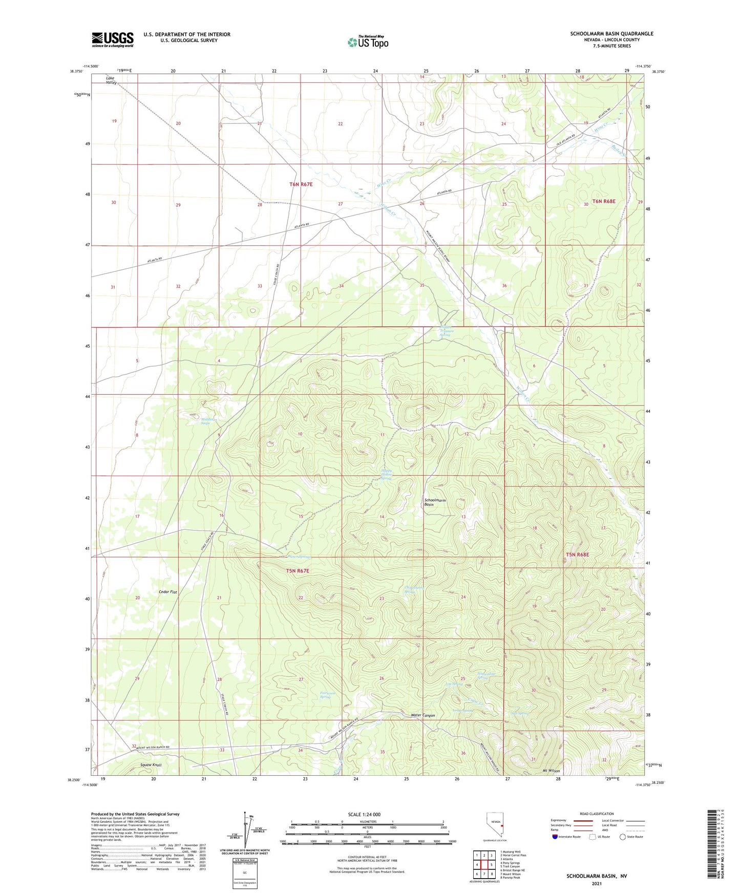
2023 topographic map quadrangle Schoolmarm Basin in the state of Nevada. Scale: 1:24000. Based on the newly updated USGS 7.5' US Topo map series, this map is in the following counties: Lincoln. The map contains contour data, water features, and other items you are used to seeing on USGS maps, but also has updated roads and other features. This is the next generation of topographic maps. Printed on high-quality waterproof paper with UV fade-resistant inks.
Quads adjacent to this one:
West: Pony Springs
Northwest: Mustang Well
North: Horse Corral Pass
Northeast: Atlanta
East: Trail Canyon
Southeast: Parsnip Peak
South: Mount Wilson
Southwest: Bristol Range NE
This map covers the same area as the classic USGS quad with code o38114c4.
Contains the following named places: Bailey Creek, Brown Springs, Cedar Flat, Chokecherry Spring, Cole and Dolan Ranch, Fairween Spring, Happy Hollow Spring, Hidden Treasure Spring, Hogwallow Spring, Karo, Karo Post Office, Ledge Spring, Log Spring, Middleton Seeps, Mount Wilson Guest Ranch Airport, Nores Ranch, Salt Spring, Schoolmarm Basin, Upper Wilson Creek Ranch, Valley View Farm, Water Canyon, Winz Creek, ZIP Code: 89043