MyTopo
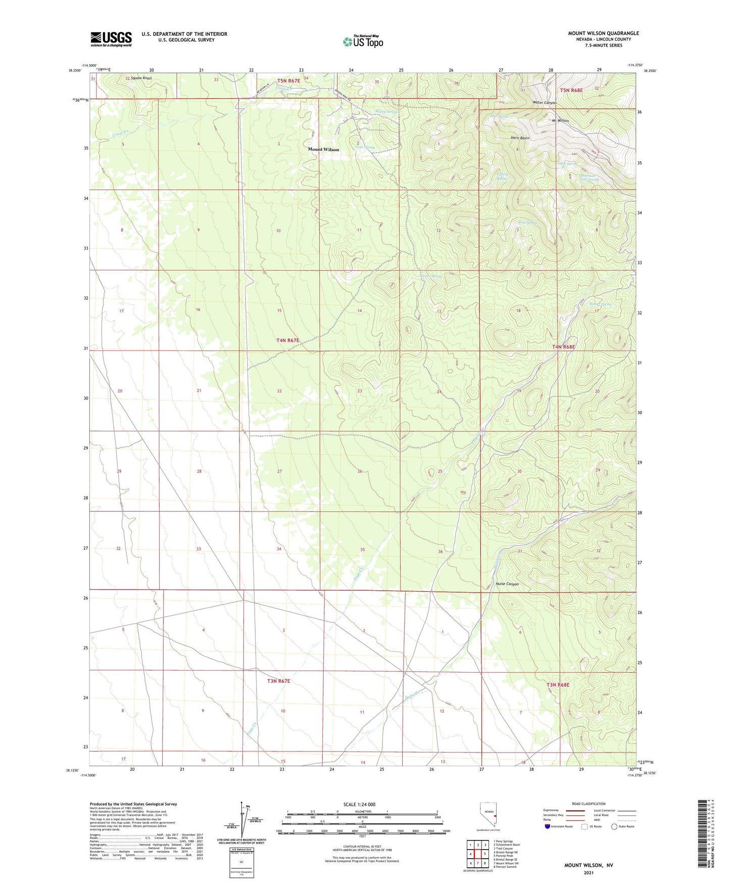
Mount Wilson Nevada US Topo Map
Couldn't load pickup availability
2023 topographic map quadrangle Mount Wilson in the state of Nevada. Scale: 1:24000. Based on the newly updated USGS 7.5' US Topo map series, this map is in the following counties: Lincoln. The map contains contour data, water features, and other items you are used to seeing on USGS maps, but also has updated roads and other features. This is the next generation of topographic maps. Printed on high-quality waterproof paper with UV fade-resistant inks.
Quads adjacent to this one:
West: Bristol Range NE
Northwest: Pony Springs
North: Schoolmarm Basin
Northeast: Trail Canyon
East: Parsnip Peak
Southeast: Pierson Summit
South: Mount Wilson SW
Southwest: Bristol Range SE
This map covers the same area as the classic USGS quad with code o38114b4.
Contains the following named places: Badger Spring, Craw Spring, Craws Ranch, Eagle Spring, Horn Basin, Hulse Canyon, Matley Spring, Mount Wilson, Mount Wilson Census Designated Place, Mountain View Spring, Pine Spring, Quartz Spring, Rock Spring, Squaw Knoll, Taffery Spring, Wilson Creek VORTAC Station