MyTopo
Burnt Cabin Summit Nevada US Topo Map
Couldn't load pickup availability
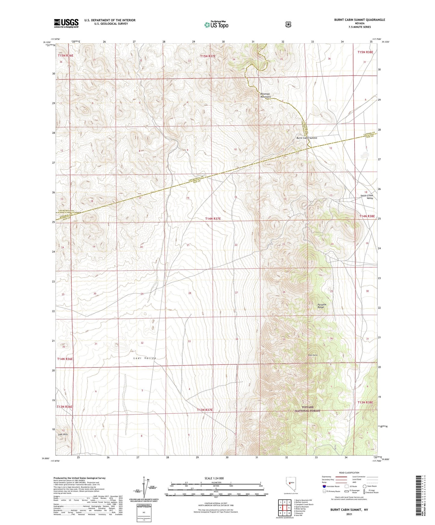
2021 topographic map quadrangle Burnt Cabin Summit in the state of Nevada. Scale: 1:24000. Based on the newly updated USGS 7.5' US Topo map series, this map is in the following counties: Nye, Churchill, Lander, Mineral. The map contains contour data, water features, and other items you are used to seeing on USGS maps, but also has updated roads and other features. This is the next generation of topographic maps. Printed on high-quality waterproof paper with UV fade-resistant inks.
Quads adjacent to this one:
West: Quartz Mountain
Northwest: Quartz Mountain NW
North: Buffalo Summit
Northeast: Campbell Creek Ranch
East: Midas Spring
Southeast: Ione NW
South: Ellsworth
Southwest: Downeyville
Contains the following named places: Black Butte, Bruner, Bruner Mill, Bruner Mine, Bruner Mining District, Bruner Post Office, Bruner Well, Burnt Cabin, Burnt Cabin Summit, Chalk Wells, Derelict Mine, Duluth Mine, Negro Wells, Paymaster Mine, Penelas, Penelas Mine, Phonolite, Phonolite Mine, Phonolite Post Office, Porter Station, Tri-County Well