MyTopo
Silver Springs North Nevada US Topo Map
Couldn't load pickup availability
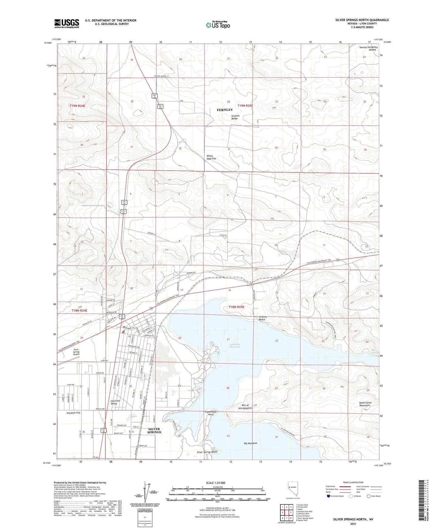
2021 topographic map quadrangle Silver Springs North in the state of Nevada. Scale: 1:24000. Based on the newly updated USGS 7.5' US Topo map series, this map is in the following counties: Lyon. The map contains contour data, water features, and other items you are used to seeing on USGS maps, but also has updated roads and other features. This is the next generation of topographic maps. Printed on high-quality waterproof paper with UV fade-resistant inks.
Quads adjacent to this one:
West: Stockton Flat Well
Northwest: Fernley West
North: Fernley East
Northeast: Hazen
East: Lahontan Dam
Southeast: Hooten Well
South: Silver Springs South
Southwest: Churchill Butte
This map covers the same area as the classic USGS quad with code o39119d2.
Contains the following named places: Appian Siding, Big Meadows, Central Lyon County Fire Protection District Silver Springs Volunteer Fire Department Station 32, Fishermans Point, Hawes Station, Honey Lake, Lahontan Reservoir, Lahontan State Recreation Area, Lyon County Sheriff's Office, Mountain of Hieroglyphics, Nevada Station, Sage Flat Well, Silver Springs, Silver Springs Airport, Silver Springs Census Designated Place, Silver Springs Marina, Silver Springs Post Office, Virginia Beach, White Sage Flat