MyTopo
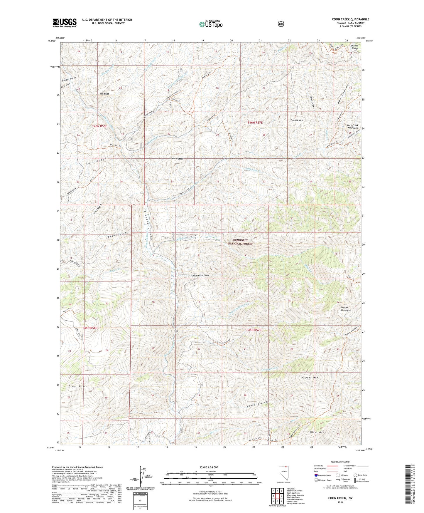
Coon Creek Nevada US Topo Map
Couldn't load pickup availability
Also explore the Coon Creek Forest Service Topo of this same quad for updated USFS data
2021 topographic map quadrangle Coon Creek in the state of Nevada. Scale: 1:24000. Based on the newly updated USGS 7.5' US Topo map series, this map is in the following counties: Elko. The map contains contour data, water features, and other items you are used to seeing on USGS maps, but also has updated roads and other features. This is the next generation of topographic maps. Printed on high-quality waterproof paper with UV fade-resistant inks.
Quads adjacent to this one:
West: Tennessee Mountain
Northwest: Big Table
North: Bearpaw Mountain
Northeast: Jarbidge North
East: Jarbidge South
Southeast: Marys River Basin NW
South: Annie Creek
Southwest: Cornwall Mountain
This map covers the same area as the classic USGS quad with code o41115g5.
Contains the following named places: Badger Creek, Bruneau School, Bruno City, Coon Creek, Copper Mountain, Copper Mountains, Cottonwood Creek, Culver Ranch, Deer Creek, Fawn Gulch, Granite Mountain, Hoy Canyon, Humphries Cabin, Johns Creek, Johns Gulch, Little Coon Creek, Little Cottonwood Creek, Lost Gulch, Marcellini Draw, McKnight Cabin, Miller Creek, Murphy Wash, Palacio Cabins, Palacio Ranch, Pine Mountain, Red Bluff, Red Bluff Wash, Road Gulch, Rocky Gulch, Rowher Gulch, Silver Mountain, Telephone Canyon, Trail Gulch, Tucker Ranch, Twin Buttes, Wickiup Creek, Young American Creek