MyTopo
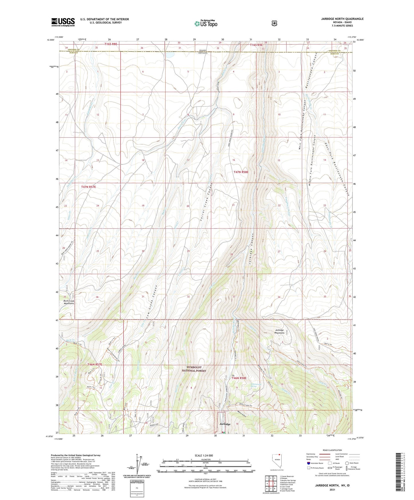
Jarbidge North Nevada US Topo Map
Couldn't load pickup availability
Also explore the Jarbidge North Forest Service Topo of this same quad for updated USFS data
2021 topographic map quadrangle Jarbidge North in the state of Nevada. Scale: 1:24000. Based on the newly updated USGS 7.5' US Topo map series, this map is in the following counties: Elko, Owyhee. The map contains contour data, water features, and other items you are used to seeing on USGS maps, but also has updated roads and other features. This is the next generation of topographic maps. Printed on high-quality waterproof paper with UV fade-resistant inks.
Quads adjacent to this one:
West: Bearpaw Mountain
Northwest: Cowan Reservoir
North: Dishpan
Northeast: Murphy Hot Springs
East: Robinson Creek
Southeast: Gods Pocket Peak
South: Jarbidge South
Southwest: Coon Creek
This map covers the same area as the classic USGS quad with code o41115h4.
Contains the following named places: Big Island, Columbet Table, Corral Creek, Corral Creek Canyon, Cottonwood Spring, Cow Creek, Cow Creek Canyon, Deer Creek, East Fork Buck Creek, East Fork Rattlesnake Canyon, Fawn Creek, Freighters Defeat, Golden Queen Mine, Jack Creek, Jack Creek Camp, Jarbidge Elementary School, Jarbidge Township, Jarbidge Volunteer Fire Department, Jenny Creek, Jones Spring Wash, Larios Ranch, Mahoney Ranger Station, Middle Fork Rattlesnake Canyon, Midnight Mine, Moore Gulch, Sanovia Creek, Sawmill National Forest Campground, Virginus Mine, Virginus Number One Mine, Virginus Number Two Mine, Ward Ranch, West Fork Rattlesnake Canyon, Wilkins Island, ZIP Code: 89826