MyTopo
Cooper Peak Nevada US Topo Map
Couldn't load pickup availability
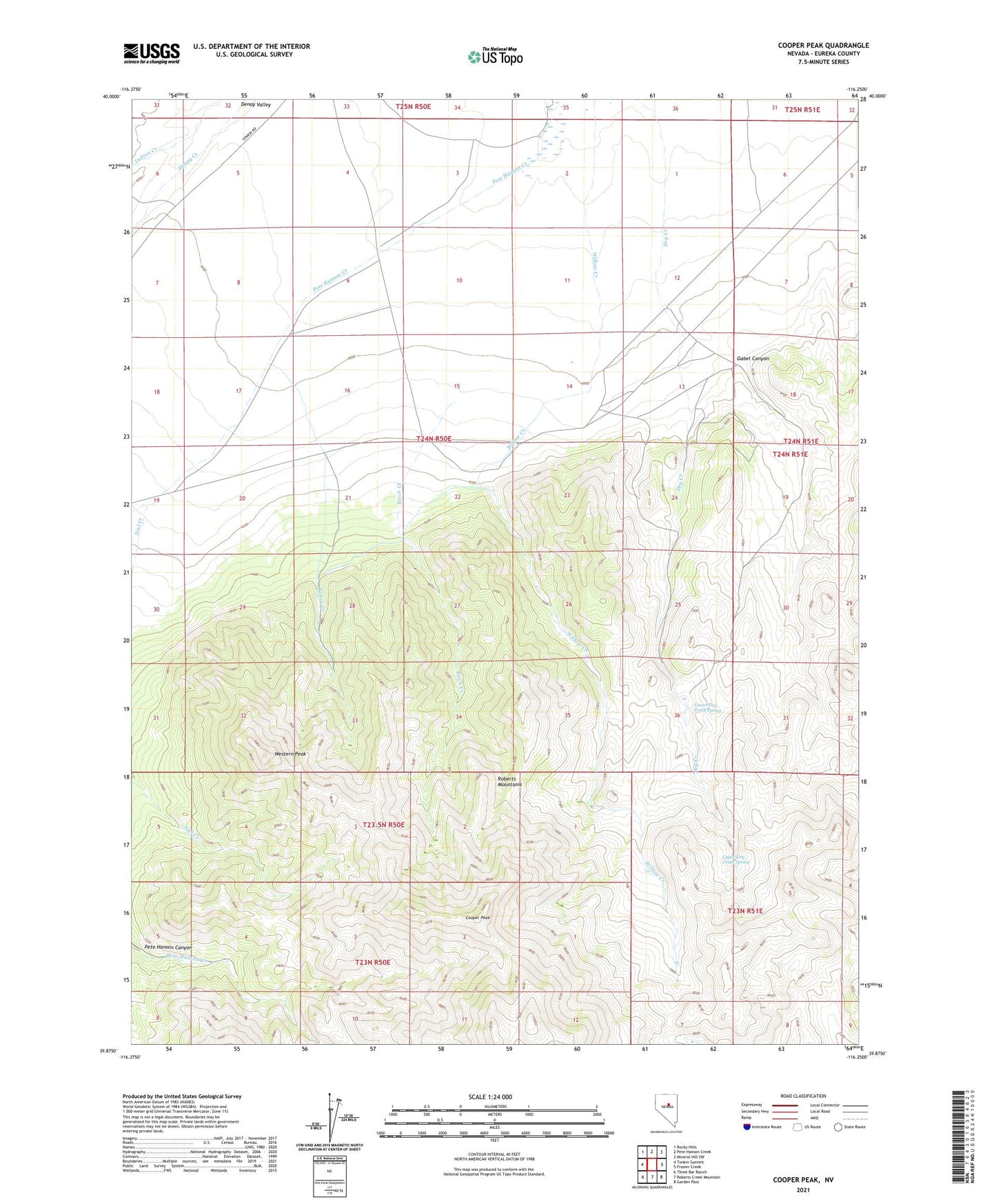
2021 topographic map quadrangle Cooper Peak in the state of Nevada. Scale: 1:24000. Based on the newly updated USGS 7.5' US Topo map series, this map is in the following counties: Eureka. The map contains contour data, water features, and other items you are used to seeing on USGS maps, but also has updated roads and other features. This is the next generation of topographic maps. Printed on high-quality waterproof paper with UV fade-resistant inks.
Quads adjacent to this one:
West: Tonkin Summit
Northwest: Rocky Hills
North: Pete Hanson Creek
Northeast: Mineral Hill SW
East: Frazier Creek
Southeast: Garden Pass
South: Roberts Creek Mountain
Southwest: Three Bar Ranch
This map covers the same area as the classic USGS quad with code o39116h3.
Contains the following named places: Birch Creek, Cooper Peak, Eureka County, Gabel Canyon, Kelley Creek, Lead Bar Mine, Lower Dry Creek Spring, Upper Dry Creek Spring, Western Peak, Willow Creek Ranch